Praia da Rocha Baixinha (Nascente-Loulé) Beach
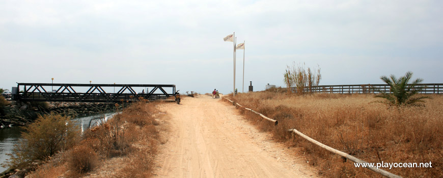
Access path towards Praia da Rocha Baixinha (East-Loulé) Beach. To the left, the Quarteira Stream.
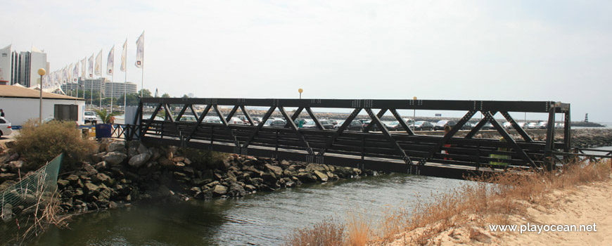
Bridge over the Quarteira Stream, between the dock of Vilamoura Marina and Praia da Rocha Baixinha (East-Loulé) Beach.
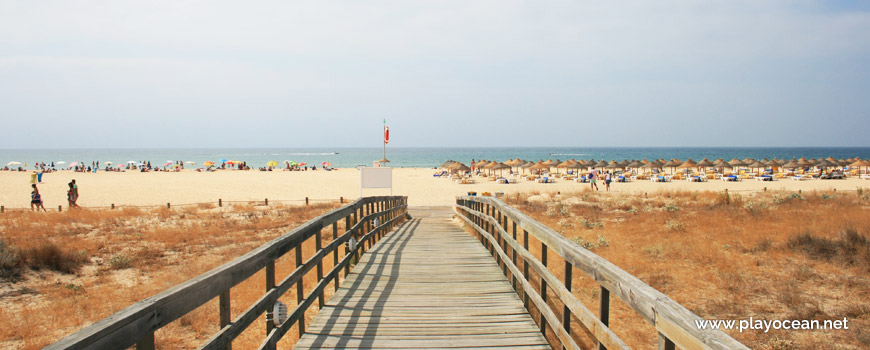
Access walkway to the sand of Praia da Rocha Baixinha (East-Loulé) Beach.
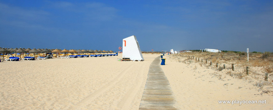
Praia da Rocha Baixinha (East-Loulé) Beach, material storage 1 and sunbeds and straw umbrellas rental.
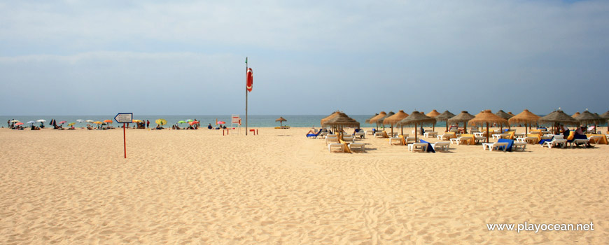
Lifeguard station, near the straw umbrellas and sunbeds exploration area.
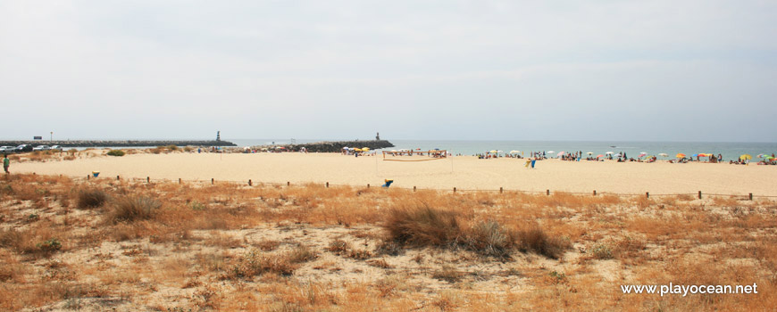
Sand at Praia da Rocha Baixinha (East-Loulé) Beach and pier of the Quarteira Stream mouth.
Weather and Tide Table
Sunrise
Sunset
0% | 3,2 m 10.5 ft | High Tide | |
1% | 0,7 m 2.3 ft | Low Tide | |
1% | 3,2 m 10.5 ft | High Tide | |
2% | 0,7 m 2.3 ft | Low Tide | |
2% | 3,2 m 10.5 ft | High Tide | |
3% | 0,8 m 2.6 ft | Low Tide | |
4% | 3,1 m 10.2 ft | High Tide | |
5% | 0,8 m 2.6 ft | Low Tide | |
6% | 3,1 m 10.2 ft | High Tide | |
7% | 0,9 m 3 ft | Low Tide | |
9% | 3,0 m 9.8 ft | High Tide | |
10% | 0,9 m 3 ft | Low Tide | |
12% | 3,1 m 10.2 ft | High Tide | |
13% | 1,0 m 3.3 ft | Low Tide | |
15% | 2,9 m 9.5 ft | High Tide | |
17% | 1,1 m 3.6 ft | Low Tide | |
19% | 2,9 m 9.5 ft | High Tide | |
20% | 1,1 m 3.6 ft | Low Tide | |
22% | 2,7 m 8.9 ft | High Tide | |
24% | 1,2 m 3.9 ft | Low Tide | |
27% | 2,8 m 9.2 ft | High Tide | |
29% | 1,3 m 4.3 ft | Low Tide | |
31% | 2,6 m 8.5 ft | High Tide | |
33% | 1,4 m 4.6 ft | Low Tide | |
36% | 2,7 m 8.9 ft | High Tide | |
38% | 1,4 m 4.6 ft | Low Tide | |
41% | 2,4 m 7.9 ft | High Tide | |
43% | 1,5 m 4.9 ft | Low Tide | |
46% | 2,6 m 8.5 ft | High Tide | |
49% | 1,5 m 4.9 ft | Low Tide | |
52% | 2,4 m 7.9 ft | High Tide | |
54% | 1,6 m 5.2 ft | Low Tide | |
57% | 2,6 m 8.5 ft | High Tide | |
60% | 1,4 m 4.6 ft | Low Tide | |
63% | 2,5 m 8.2 ft | High Tide | |
65% | 1,5 m 4.9 ft | Low Tide | |
68% | 2,7 m 8.9 ft | High Tide | |
70% | 1,2 m 3.9 ft | Low Tide | |
73% | 2,7 m 8.9 ft | High Tide | |
75% | 1,3 m 4.3 ft | Low Tide | |
78% | 2,9 m 9.5 ft | High Tide | |
80% | 1,0 m 3.3 ft | Low Tide | |
83% | 2,9 m 9.5 ft | High Tide | |
About the Beach
What is Praia da Rocha Baixinha (Nascente-Loulé) Beach?
It's an Oceanic Beach in the northern hemisphere bathed by the Atlantic Ocean, located on the coast of Portugal - Iberian Peninsula - in the municipality of Loulé.
Praia da Rocha Baixinha (East-Loulé) Beach owns a wide and long sand.
At west, an invisible boundary line separating Loulé and Albufeira counties, splits Bathing Units 1 and 2, respectively.
In the east, is a pier of about 455 meters long that belongs to the Ribeira de Quarteira1 mouth.
There's a pedestrian bridge over the stream which completes access to bathing area, coming from the vast car parking and the dry dock of Marina de Vilamoura2.
This beach and its west neighboring one hold the peculiarity of being easily identifiable by the red numbers on each beach support facility, organized by the following order:
Praia da Rocha Baixinha (Nascente) Beach
- Beach Support Facility 1 (Beach Unit 1) - Loulé County
- borderline between Albufeira and Loulé Counties
- Beach Support Facility 2 (Beach Unit 2) - Albufeira County
- Beach Support Facility 3 (Beach Unit 3) - Albufeira County
- Beach Support Facility 4 (Beach Unit 4) - Albufeira County
Praia da Rocha Baixinha Beach
- Beach Support Facility 5 (Beach Unit 1) - Albufeira County
The order and/or numbers of each beach support facility are subject to change depending on the responsible authorities for beach administration.
References
- Quarteira Stream
- Vilamoura Marina
Where is it?
Map of Praia da Rocha Baixinha (Nascente-Loulé) Beach
| Coordinates Decimal Degrees (Lat/Long WGS84) Degrees, Decimal Minutes (Lat/Long WGS84) Degrees, Minutes, Seconds (Lat/Long WGS84) |
Lat. 37.074250º Lon. -8.126592º N 37º 4.455' W 8º 7.59552' N 37º 4' 27.3" W 8º 7' 35.73" |
| Parish | Quarteira |
| County | Loulé |
| District | Faro |
| Region | Algarve |
| Country | Portugal |
| Continent | Europe |
| Ocean | North Atlantic |
| Maritime Authority | Capitania do Porto de Faro |
| Protected Area | |
| Bathing Water | Rocha Baixinha - Nascente |
| Coastal Unit | Olhos de Água - Ancão |
| Coastal Region | Costa Algarvia |
Awards
| Award | 2017 | 2016 | 2015 | 2014 | 2013 | 2012 | 2011 | 2010 | 2009 | 2008 | 2007 | 2006 |
|---|---|---|---|---|---|---|---|---|---|---|---|---|
| Water Quality | ||||||||||||
| Blue Flag | ||||||||||||
| Gold Flag | ||||||||||||
| Handicapped-Accessible Beach | ||||||||||||
| Zero Polution |