Praia de Cacela Velha Beach
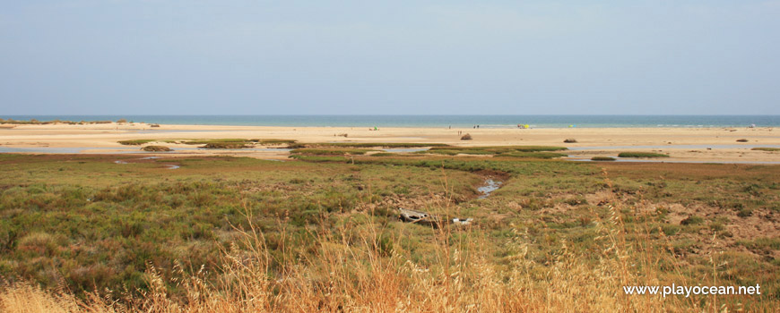
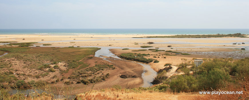
Praia de Cacela Velha Beach, view from the salt marsh land of the Formosa River.
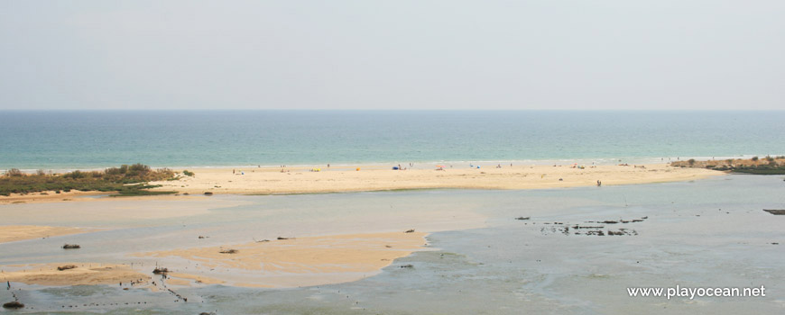
Praia de Cacela Velha Beach.
Tongue of sand at Praia de Cacela Velha Beach.
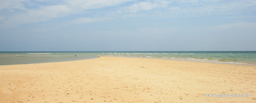
Praia de Cacela Velha Beach, by the seaside.
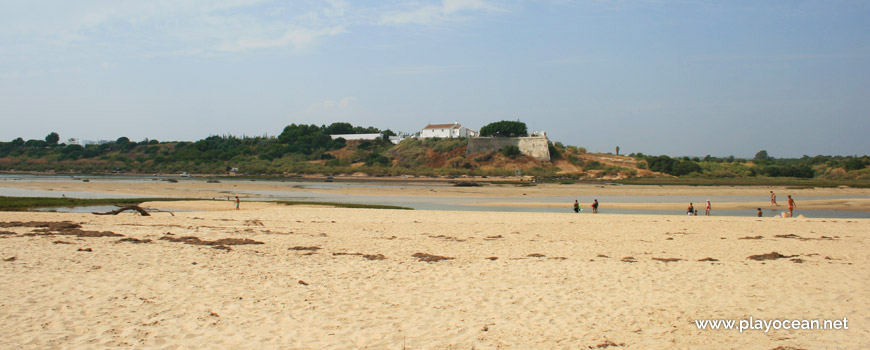
Perspective from the sand over the Cacela Fort.
Weather and Tide Table
Sunset
Sunrise
0% | 3,3 m 10.8 ft | High Tide | |
1% | 0,9 m 3 ft | Low Tide | |
1% | 3,3 m 10.8 ft | High Tide | |
2% | 0,9 m 3 ft | Low Tide | |
2% | 3,3 m 10.8 ft | High Tide | |
3% | 0,9 m 3 ft | Low Tide | |
4% | 3,2 m 10.5 ft | High Tide | |
5% | 0,9 m 3 ft | Low Tide | |
6% | 3,3 m 10.8 ft | High Tide | |
7% | 1,0 m 3.3 ft | Low Tide | |
9% | 3,1 m 10.2 ft | High Tide | |
10% | 1,0 m 3.3 ft | Low Tide | |
12% | 3,2 m 10.5 ft | High Tide | |
13% | 1,1 m 3.6 ft | Low Tide | |
15% | 3,0 m 9.8 ft | High Tide | |
17% | 1,2 m 3.9 ft | Low Tide | |
19% | 3,1 m 10.2 ft | High Tide | |
20% | 1,2 m 3.9 ft | Low Tide | |
22% | 2,9 m 9.5 ft | High Tide | |
24% | 1,3 m 4.3 ft | Low Tide | |
27% | 3,0 m 9.8 ft | High Tide | |
29% | 1,4 m 4.6 ft | Low Tide | |
31% | 2,7 m 8.9 ft | High Tide | |
33% | 1,5 m 4.9 ft | Low Tide | |
36% | 2,8 m 9.2 ft | High Tide | |
38% | 1,6 m 5.2 ft | Low Tide | |
41% | 2,6 m 8.5 ft | High Tide | |
43% | 1,7 m 5.6 ft | Low Tide | |
46% | 2,8 m 9.2 ft | High Tide | |
49% | 1,7 m 5.6 ft | Low Tide | |
52% | 2,5 m 8.2 ft | High Tide | |
54% | 1,8 m 5.9 ft | Low Tide | |
57% | 2,8 m 9.2 ft | High Tide | |
60% | 1,6 m 5.2 ft | Low Tide | |
63% | 2,6 m 8.5 ft | High Tide | |
65% | 1,7 m 5.6 ft | Low Tide | |
68% | 2,9 m 9.5 ft | High Tide | |
70% | 1,4 m 4.6 ft | Low Tide | |
73% | 2,8 m 9.2 ft | High Tide | |
75% | 1,5 m 4.9 ft | Low Tide | |
78% | 3,1 m 10.2 ft | High Tide | |
80% | 1,2 m 3.9 ft | Low Tide | |
83% | 3,1 m 10.2 ft | High Tide | |
About the Beach
What is Praia de Cacela Velha Beach?
It's an Oceanic Beach in the northern hemisphere bathed by the Atlantic Ocean, located on the coast of Portugal - Iberian Peninsula - in the municipality of Vila Real de Santo António (West).
Praia da Cacela Velha Beach has a very long sand of about 1,7 Km.
The dune string becomes wider while the river narrows to the east.
This is the most eastern beach in the Parque Natural da Ria Formosa1.
At the opposite margin of the canal, can be sighted the Forte da Cacela2 and the Ribeira de Cacela3 mouth, where its margins hold an important fossil deposit.
Access is done by boat from the fishing village, through the east neighboring beach sand or during low tide.
References
- Ria Formosa Natural Park
- Cacela Fort
- Cacela Stream
Where is it?
Map of Praia de Cacela Velha Beach
| Coordinates Decimal Degrees (Lat/Long WGS84) Degrees, Decimal Minutes (Lat/Long WGS84) Degrees, Minutes, Seconds (Lat/Long WGS84) |
Lat. 37.152899º Lon. -7.542722º N 37º 9.17394' W 7º 32.56332' N 37º 9' 10.44" W 7º 32' 33.8" |
| Parish | Vila Nova de Cacela |
| County | Vila Real de Santo António (West) |
| District | Faro |
| Region | Algarve |
| Country | Portugal |
| Continent | Europe |
| Ocean | North Atlantic |
| Maritime Authority | Capitania do Porto de Vila Real de Santo António |
| Protected Area | Parque Natural da Ria Formosa |
| Bathing Water | |
| Coastal Unit | Cabo Santa Maria - Manta Rota |
| Coastal Region | Costa Algarvia |
Awards
| Award | 2017 | 2016 | 2015 | 2014 | 2013 | 2012 | 2011 | 2010 | 2009 | 2008 | 2007 | 2006 |
|---|---|---|---|---|---|---|---|---|---|---|---|---|
| Water Quality | ||||||||||||
| Blue Flag | ||||||||||||
| Gold Flag | ||||||||||||
| Handicapped-Accessible Beach | ||||||||||||
| Zero Polution |