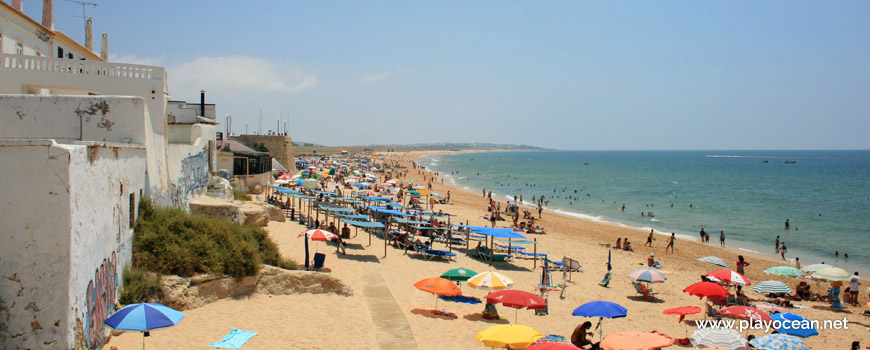
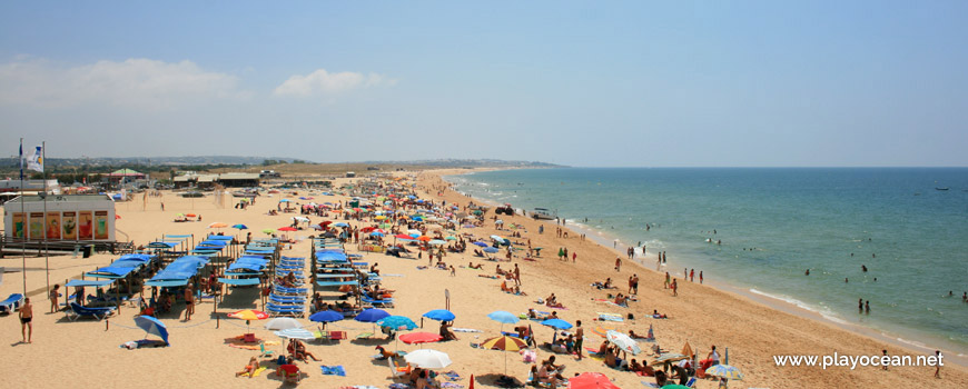
Praia de Armação de Pêra Beach
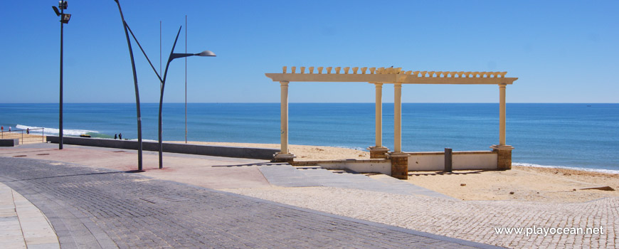
Seaside road in Portuguese Pavement, near Praia de Armação de Pêra Beach.
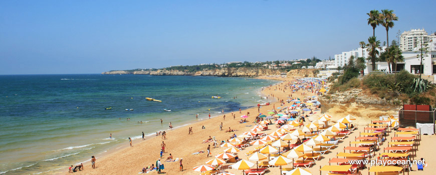
Sand at Praia de Armação de Pêra Beach, in fron of Hotel Holiday Inn.
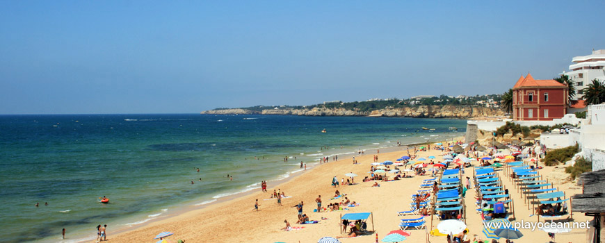
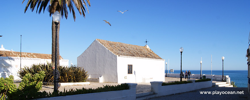
View over the east side of the Chalet dos Caldas e Vasconcelos, at Praia de Armação de Pêra Beach.
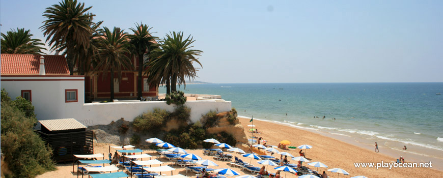
The Chalet dos Caldas e Vasconcelos at Praia de Armação de Pêra Beach.
Praia de Armação de Pêra Beach, east perspective over the Armação de Pêra Fortress.
East perspective, from the Armação de Pêra Fortress.
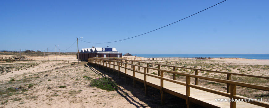
Access walkway to the sand of Praia de Armação de Pêra Beach, over the dunes.
Praia de Armação de Pêra Beach. Far, small fishing vessels on the sand.
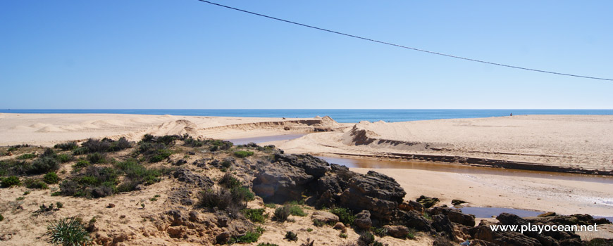
Bed of the Alcantarilha Stream, near its mouth.
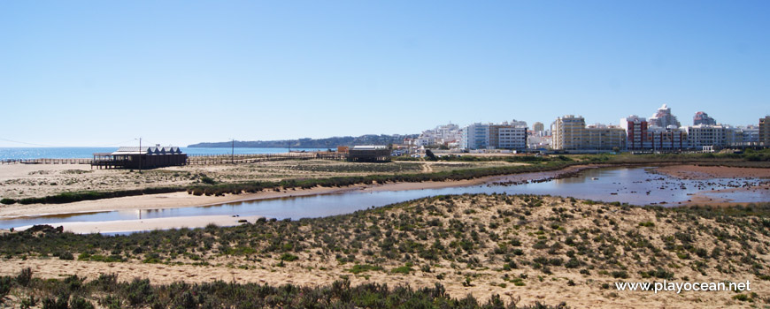
The Alcantarilha Stream and dwellings of Armação de Pêra village, far.
The Santo António Chapel, in the interior of the Armação de Pêra Fortress.
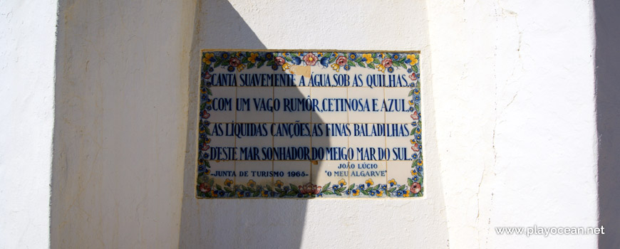
Tile panel near Praia de Armação de Pêra Beach: Sings gently the water, over the keels,
With a vague rumor, satin and blue,
The liquid songs, the thin ballads
From this dreamer sea, the gentle sea from the south.
Weather and Tide Table
Sunrise
Sunset
0% | 3,3 m 10.8 ft | High Tide | |
1% | 0,7 m 2.3 ft | Low Tide | |
1% | 3,3 m 10.8 ft | High Tide | |
2% | 0,7 m 2.3 ft | Low Tide | |
2% | 3,3 m 10.8 ft | High Tide | |
3% | 0,8 m 2.6 ft | Low Tide | |
4% | 3,2 m 10.5 ft | High Tide | |
5% | 0,8 m 2.6 ft | Low Tide | |
6% | 3,2 m 10.5 ft | High Tide | |
7% | 0,8 m 2.6 ft | Low Tide | |
9% | 3,1 m 10.2 ft | High Tide | |
10% | 0,9 m 3 ft | Low Tide | |
12% | 3,1 m 10.2 ft | High Tide | |
13% | 1,0 m 3.3 ft | Low Tide | |
15% | 2,9 m 9.5 ft | High Tide | |
17% | 1,1 m 3.6 ft | Low Tide | |
18% | 3,0 m 9.8 ft | High Tide | |
20% | 1,1 m 3.6 ft | Low Tide | |
22% | 2,7 m 8.9 ft | High Tide | |
24% | 1,3 m 4.3 ft | Low Tide | |
27% | 2,8 m 9.2 ft | High Tide | |
29% | 1,3 m 4.3 ft | Low Tide | |
31% | 2,6 m 8.5 ft | High Tide | |
33% | 1,4 m 4.6 ft | Low Tide | |
36% | 2,7 m 8.9 ft | High Tide | |
38% | 1,4 m 4.6 ft | Low Tide | |
41% | 2,4 m 7.9 ft | High Tide | |
43% | 1,6 m 5.2 ft | Low Tide | |
46% | 2,6 m 8.5 ft | High Tide | |
49% | 1,5 m 4.9 ft | Low Tide | |
52% | 2,4 m 7.9 ft | High Tide | |
54% | 1,6 m 5.2 ft | Low Tide | |
57% | 2,6 m 8.5 ft | High Tide | |
60% | 1,4 m 4.6 ft | Low Tide | |
62% | 2,5 m 8.2 ft | High Tide | |
65% | 1,5 m 4.9 ft | Low Tide | |
68% | 2,7 m 8.9 ft | High Tide | |
70% | 1,2 m 3.9 ft | Low Tide | |
73% | 2,7 m 8.9 ft | High Tide | |
75% | 1,3 m 4.3 ft | Low Tide | |
78% | 3,0 m 9.8 ft | High Tide | |
80% | 1,0 m 3.3 ft | Low Tide | |
83% | 2,9 m 9.5 ft | High Tide | |
About the Beach
What is Praia de Armação de Pêra Beach?
It's an Oceanic Beach in the northern hemisphere bathed by the Atlantic Ocean, located on the coast of Portugal - Iberian Peninsula - in the municipality of Silves.
Praia de Armação de Pêra Beach, also known as Praia de Pêra de Santo António Beach, has a very extensive sand of about 1,6 Km. It was called so because of the several fishing boats that formerly used fishing frames1 for tuna fishing. This was a common practice until the year of 1905.
At west, the Ribeira do Vale do Olival2 mixes with the gentle sea waters.
At the the mid section, near the beach, there's a garden (where once was the well known Minigolfe) and the Chalet dos Caldas e Vasconcelos3. The emblematic Fortaleza de Armação de Pêra4 arises nearby.
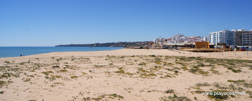
At east, the sand known as Praia dos Barcos Beach or Praia dos Pescadores Beach5, presents us with a large amalgam of small traditional fishing boats. Its eastern end, right beside the Ribeira de Alcantarilha ou da Enxorrada6 is called Praia de Armação de Pêra (East) Beach.
In the sea, lies the biggest natural coral reef of Portugal with a length of more than seven nautical miles and depths ranging from fourteen to twenty two meters.
This is a highly crowded beach during summer season.
References
- "Armações", in Portuguese.
- Vale do Olival Stream
- Caldas e Vasconcelos Chalet
- Armação de Pêra Fort
- Fishermen Beach
- Alcantarilha Stream also known as Enxorrada Stream
Where is it?
Map of Praia de Armação de Pêra Beach
| Coordinates Decimal Degrees (Lat/Long WGS84) Degrees, Decimal Minutes (Lat/Long WGS84) Degrees, Minutes, Seconds (Lat/Long WGS84) |
Lat. 37.100403º Lon. -8.358712º N 37º 6.02418' W 8º 21.52272' N 37º 6' 1.45" W 8º 21' 31.36" |
| Parish | Armação de Pêra |
| County | Silves |
| District | Faro |
| Region | Algarve |
| Country | Portugal |
| Continent | Europe |
| Ocean | North Atlantic |
| Maritime Authority | Capitania do Porto de Portimão |
| Protected Area | |
| Bathing Water | Armação de Pêra |
| Coastal Unit | Armação de Pêra (W) - Ponta do Castelo |
| Coastal Region | Costa Algarvia |
Awards
| Award | 2017 | 2016 | 2015 | 2014 | 2013 | 2012 | 2011 | 2010 | 2009 | 2008 | 2007 | 2006 |
|---|---|---|---|---|---|---|---|---|---|---|---|---|
| Water Quality | ||||||||||||
| Blue Flag | ||||||||||||
| Gold Flag | ||||||||||||
| Handicapped-Accessible Beach | ||||||||||||
| Zero Polution |
Documents
Reviews (1)
Login to Review.
-
10/ 10Uma praia deslumbrante... fora da época balnear!Simão Correia 2019-03-29 17:20