Praia de Ofir Beach
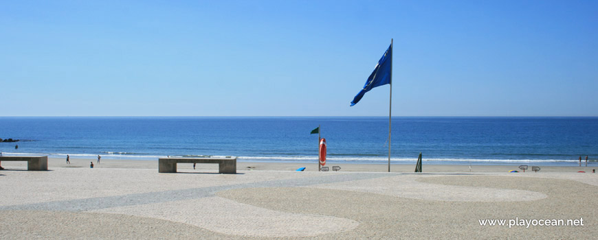
Blue Flag banner at Praia de Ofir Beach's entrance.
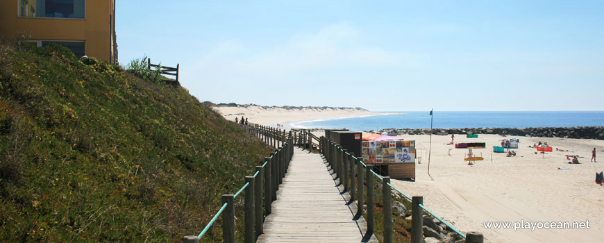
Praia de Ofir Beach, wooden walkway towards south.
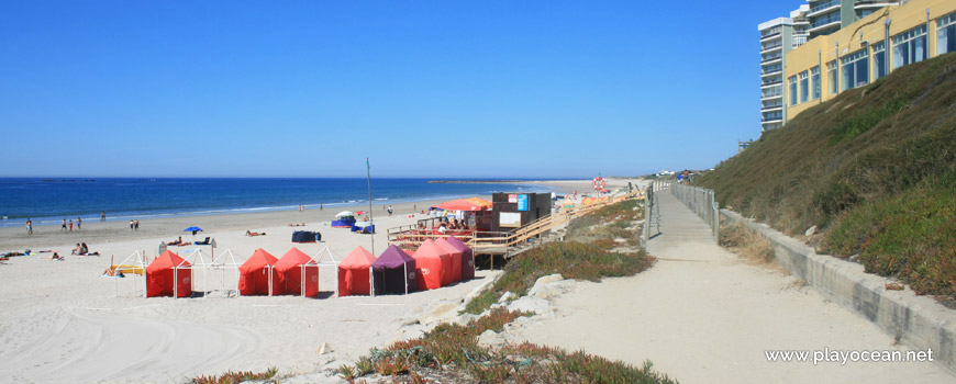
Barracks by the concession at Praia de Ofir Beach.
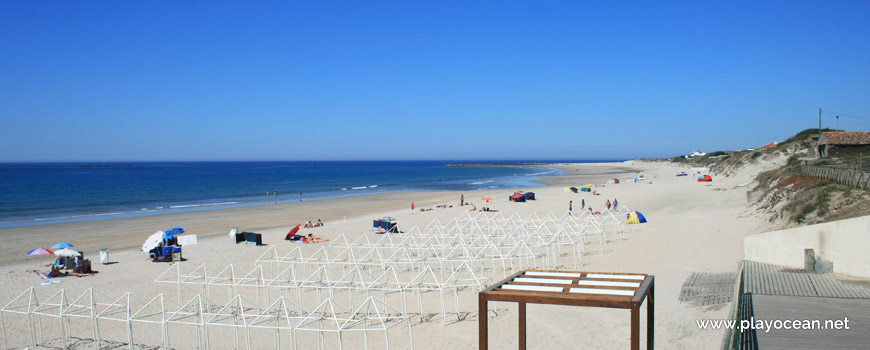
Barrack frames at the sand of Praia de Ofir Beach.
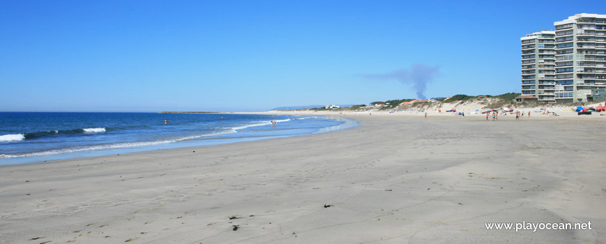
Praia de Ofir Beach, north view.
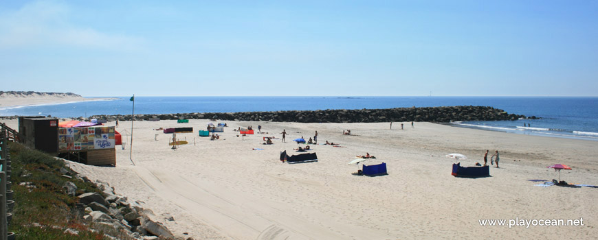
South area of Praia de Ofir Beach.
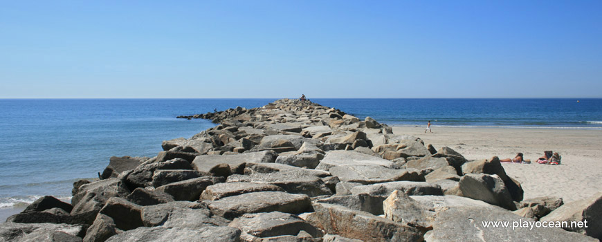
Pier at Praia de Ofir Beach.
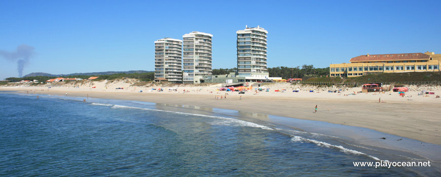
View to Praia de Ofir Beach and the houses on the sea front, from the pier.
Weather and Tide Table
Sunrise
Sunset
0% | 3,3 m 10.8 ft | High Tide | |
1% | 0,7 m 2.3 ft | Low Tide | |
1% | 3,3 m 10.8 ft | High Tide | |
2% | 0,7 m 2.3 ft | Low Tide | |
2% | 3,3 m 10.8 ft | High Tide | |
3% | 0,7 m 2.3 ft | Low Tide | |
4% | 3,2 m 10.5 ft | High Tide | |
5% | 0,8 m 2.6 ft | Low Tide | |
6% | 3,2 m 10.5 ft | High Tide | |
7% | 0,8 m 2.6 ft | Low Tide | |
9% | 3,1 m 10.2 ft | High Tide | |
10% | 0,9 m 3 ft | Low Tide | |
12% | 3,1 m 10.2 ft | High Tide | |
13% | 1,0 m 3.3 ft | Low Tide | |
15% | 2,9 m 9.5 ft | High Tide | |
17% | 1,1 m 3.6 ft | Low Tide | |
19% | 3,0 m 9.8 ft | High Tide | |
21% | 1,1 m 3.6 ft | Low Tide | |
23% | 2,8 m 9.2 ft | High Tide | |
25% | 1,2 m 3.9 ft | Low Tide | |
27% | 2,9 m 9.5 ft | High Tide | |
29% | 1,3 m 4.3 ft | Low Tide | |
31% | 2,6 m 8.5 ft | High Tide | |
34% | 1,4 m 4.6 ft | Low Tide | |
36% | 2,7 m 8.9 ft | High Tide | |
39% | 1,4 m 4.6 ft | Low Tide | |
41% | 2,4 m 7.9 ft | High Tide | |
44% | 1,5 m 4.9 ft | Low Tide | |
46% | 2,6 m 8.5 ft | High Tide | |
49% | 1,5 m 4.9 ft | Low Tide | |
52% | 2,4 m 7.9 ft | High Tide | |
54% | 1,6 m 5.2 ft | Low Tide | |
57% | 2,6 m 8.5 ft | High Tide | |
60% | 1,4 m 4.6 ft | Low Tide | |
63% | 2,5 m 8.2 ft | High Tide | |
65% | 1,5 m 4.9 ft | Low Tide | |
68% | 2,8 m 9.2 ft | High Tide | |
71% | 1,2 m 3.9 ft | Low Tide | |
73% | 2,7 m 8.9 ft | High Tide | |
76% | 1,3 m 4.3 ft | Low Tide | |
78% | 3,0 m 9.8 ft | High Tide | |
80% | 1,0 m 3.3 ft | Low Tide | |
83% | 2,9 m 9.5 ft | High Tide | |
About the Beach
What is Praia de Ofir Beach?
It's an Oceanic Beach in the northern hemisphere bathed by the Atlantic Ocean, located on the coast of Portugal - Iberian Peninsula - in the municipality of Esposende.
Praia de Ofir Beach is part of the Rio Cávado1 mouth by the south margin. It is mid divided by a pier and there's another one to the south bounding the beach.
A very extensive sand of about 2,7 Km ends north, in the form of a sandy strip which meets the river mouth and delights bathers.
This beach attracts very people of younger generations due to the vicinity of nightlife.
Access is granted by turning to Avenida António Veiga2 right after the bridge (north-south direction), coming from Estrada Nacional 133.
References
- Cávado River
- António Veiga Street
- National Road 13
Where is it?
Map of Praia de Ofir Beach
| Coordinates Decimal Degrees (Lat/Long WGS84) Degrees, Decimal Minutes (Lat/Long WGS84) Degrees, Minutes, Seconds (Lat/Long WGS84) |
Lat. 41.517300º Lon. -8.787520º N 41º 31.038' W 8º 47.2512' N 41º 31' 2.28" W 8º 47' 15.07" |
| Parish | Fão |
| County | Esposende |
| District | Braga |
| Region | Minho |
| Country | Portugal |
| Continent | Europe |
| Ocean | North Atlantic |
| Maritime Authority | Capitania do Porto de Viana do Castelo |
| Protected Area | Parque Natural do Litoral Norte |
| Bathing Water | Fão - Ofir |
| Coastal Unit | Foz do Rio Lima (N) - Cabo de Santo André |
| Coastal Region | Costa Verde |
Awards
| Award | 2017 | 2016 | 2015 | 2014 | 2013 | 2012 | 2011 | 2010 | 2009 | 2008 | 2007 | 2006 |
|---|---|---|---|---|---|---|---|---|---|---|---|---|
| Water Quality | ||||||||||||
| Blue Flag | ||||||||||||
| Gold Flag | ||||||||||||
| Handicapped-Accessible Beach | ||||||||||||
| Zero Polution |