Praia da Ilha do Farol (Mar) Beach
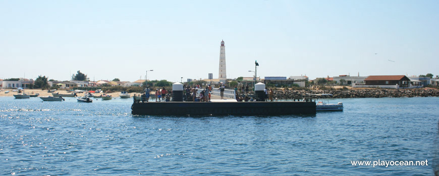
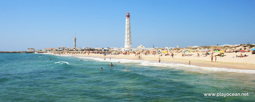
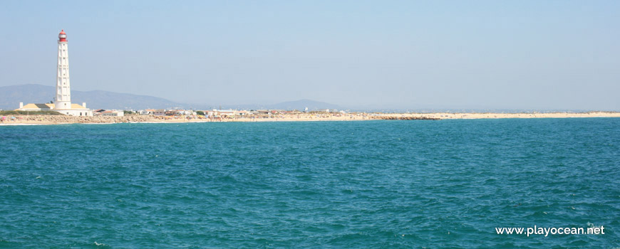
Wharf of Farol Island. In the rear, the Cabo de Santa Maria Lighthouse.
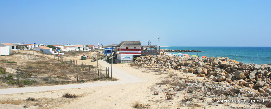
Access path to Praia da Ilha do Farol (Sea) Beach.
Praia da Ilha do Farol (Sea) Beach, near the seawall.
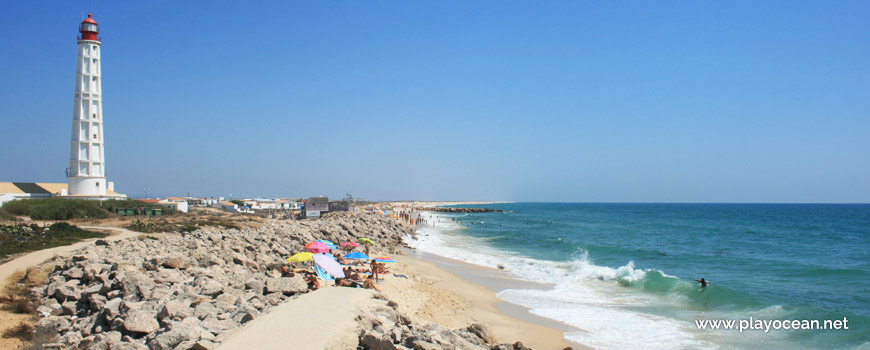
Bathing area in front of the Cabo de Santa Maria Lighthouse.
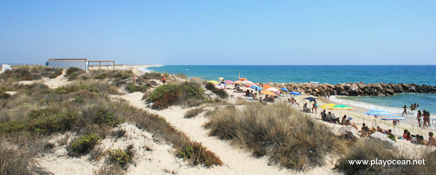
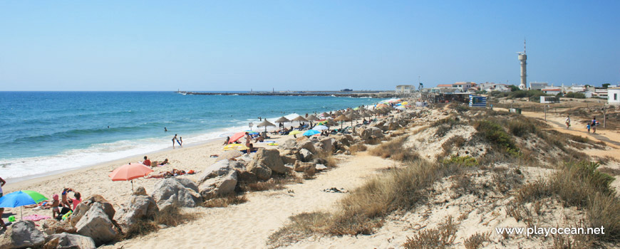
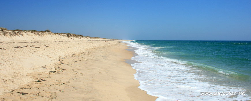
Dunes of Praia da Ilha do Farol (Sea) Beach, in the proximity of the east pier.
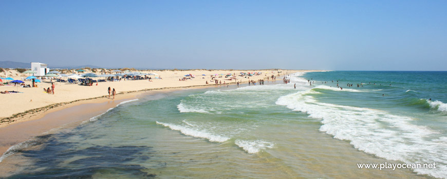
View from the east pier over Praia da Ilha do Farol (Sea) Beach. In the center, the Cabo de Santa Maria Lighthouse.
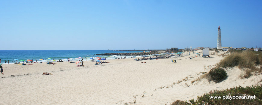
Sand of Praia da Ilha do Farol (Sea) Beach, near the east pier.
Praia da Ilha do Farol (Sea) Beach, perspective from the dune system.
Bathing area east from the piers of Praia da Ilha do Farol (Sea) Beach.
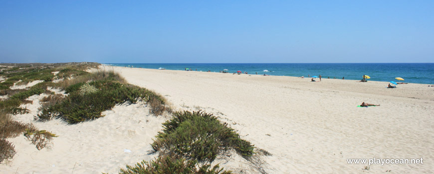
East view at Praia da Ilha do Farol (Sea) Beach.
Panoramic view over Praia da Ilha do Farol (Sea) Beach, from the ferry.
Weather and Tide Table
Sunset
Sunrise
0% | 3,2 m 10.5 ft | High Tide | |
1% | 0,7 m 2.3 ft | Low Tide | |
1% | 3,2 m 10.5 ft | High Tide | |
2% | 0,7 m 2.3 ft | Low Tide | |
2% | 3,2 m 10.5 ft | High Tide | |
3% | 0,8 m 2.6 ft | Low Tide | |
4% | 3,1 m 10.2 ft | High Tide | |
5% | 0,8 m 2.6 ft | Low Tide | |
6% | 3,1 m 10.2 ft | High Tide | |
7% | 0,9 m 3 ft | Low Tide | |
9% | 3,0 m 9.8 ft | High Tide | |
10% | 0,9 m 3 ft | Low Tide | |
12% | 3,1 m 10.2 ft | High Tide | |
13% | 1,0 m 3.3 ft | Low Tide | |
15% | 2,9 m 9.5 ft | High Tide | |
17% | 1,1 m 3.6 ft | Low Tide | |
19% | 2,9 m 9.5 ft | High Tide | |
20% | 1,1 m 3.6 ft | Low Tide | |
22% | 2,7 m 8.9 ft | High Tide | |
24% | 1,2 m 3.9 ft | Low Tide | |
27% | 2,8 m 9.2 ft | High Tide | |
29% | 1,3 m 4.3 ft | Low Tide | |
31% | 2,6 m 8.5 ft | High Tide | |
33% | 1,4 m 4.6 ft | Low Tide | |
36% | 2,7 m 8.9 ft | High Tide | |
38% | 1,4 m 4.6 ft | Low Tide | |
41% | 2,4 m 7.9 ft | High Tide | |
43% | 1,5 m 4.9 ft | Low Tide | |
46% | 2,6 m 8.5 ft | High Tide | |
49% | 1,5 m 4.9 ft | Low Tide | |
52% | 2,4 m 7.9 ft | High Tide | |
54% | 1,6 m 5.2 ft | Low Tide | |
57% | 2,6 m 8.5 ft | High Tide | |
60% | 1,4 m 4.6 ft | Low Tide | |
63% | 2,5 m 8.2 ft | High Tide | |
65% | 1,5 m 4.9 ft | Low Tide | |
68% | 2,7 m 8.9 ft | High Tide | |
70% | 1,2 m 3.9 ft | Low Tide | |
73% | 2,7 m 8.9 ft | High Tide | |
75% | 1,3 m 4.3 ft | Low Tide | |
78% | 2,9 m 9.5 ft | High Tide | |
80% | 1,0 m 3.3 ft | Low Tide | |
83% | 2,9 m 9.5 ft | High Tide | |
About the Beach
What is Praia da Ilha do Farol (Mar) Beach?
It's an Oceanic Beach in the northern hemisphere bathed by the Atlantic Ocean, located on the coast of Portugal - Iberian Peninsula - in the municipality of Faro.
Praia da Ilha do Farol (Sea) Beach is in a sandy island called Ilha da Culatra1, at the heart of Ria Formosa2 (a valley eroded by rivers and with sandy islands which is flooded by the sea, turning the water into brackish).
The sand is very long of about 1,7 Km and the dune system is wide.
At west, beside the fishermen village holding the famous Farol do Cabo de Santa Maria3, the beach is bounded by a 900 meter long pier, guiding the boats entry in the Canal de Faro4.
Access is via sea.
References
- Culatra Island
- Formosa River
- Santa Maria Cape Lighthouse
- Faro Canal
Where is it?
Map of Praia da Ilha do Farol (Mar) Beach
| Coordinates Decimal Degrees (Lat/Long WGS84) Degrees, Decimal Minutes (Lat/Long WGS84) Degrees, Minutes, Seconds (Lat/Long WGS84) |
Lat. 36.974397º Lon. -7.863819º N 36º 58.46382' W 7º 51.82914' N 36º 58' 27.83" W 7º 51' 49.75" |
| Parish | Sé |
| County | Faro |
| District | Faro |
| Region | Algarve |
| Country | Portugal |
| Continent | Europe |
| Ocean | North Atlantic |
| Maritime Authority | Capitania do Porto de Olhão |
| Protected Area | Parque Natural da Ria Formosa |
| Bathing Water | Ilha do Farol - Mar |
| Coastal Unit | Cabo Santa Maria - Manta Rota |
| Coastal Region | Costa Algarvia |
Awards
| Award | 2017 | 2016 | 2015 | 2014 | 2013 | 2012 | 2011 | 2010 | 2009 | 2008 | 2007 | 2006 |
|---|---|---|---|---|---|---|---|---|---|---|---|---|
| Water Quality | ||||||||||||
| Blue Flag | ||||||||||||
| Gold Flag | ||||||||||||
| Handicapped-Accessible Beach | ||||||||||||
| Zero Polution |