Weather and Tide Table
Sunrise
Sunset
0% | 3,3 m 10.8 ft | High Tide | |
1% | 0,7 m 2.3 ft | Low Tide | |
1% | 3,3 m 10.8 ft | High Tide | |
2% | 0,7 m 2.3 ft | Low Tide | |
2% | 3,3 m 10.8 ft | High Tide | |
3% | 0,8 m 2.6 ft | Low Tide | |
4% | 3,2 m 10.5 ft | High Tide | |
5% | 0,8 m 2.6 ft | Low Tide | |
6% | 3,2 m 10.5 ft | High Tide | |
7% | 0,9 m 3 ft | Low Tide | |
9% | 3,1 m 10.2 ft | High Tide | |
10% | 0,9 m 3 ft | Low Tide | |
12% | 3,1 m 10.2 ft | High Tide | |
13% | 1,0 m 3.3 ft | Low Tide | |
15% | 2,9 m 9.5 ft | High Tide | |
17% | 1,1 m 3.6 ft | Low Tide | |
19% | 3,0 m 9.8 ft | High Tide | |
21% | 1,1 m 3.6 ft | Low Tide | |
23% | 2,7 m 8.9 ft | High Tide | |
25% | 1,2 m 3.9 ft | Low Tide | |
27% | 2,9 m 9.5 ft | High Tide | |
29% | 1,3 m 4.3 ft | Low Tide | |
31% | 2,6 m 8.5 ft | High Tide | |
34% | 1,4 m 4.6 ft | Low Tide | |
36% | 2,7 m 8.9 ft | High Tide | |
39% | 1,4 m 4.6 ft | Low Tide | |
41% | 2,4 m 7.9 ft | High Tide | |
44% | 1,5 m 4.9 ft | Low Tide | |
46% | 2,6 m 8.5 ft | High Tide | |
49% | 1,5 m 4.9 ft | Low Tide | |
52% | 2,4 m 7.9 ft | High Tide | |
54% | 1,6 m 5.2 ft | Low Tide | |
57% | 2,6 m 8.5 ft | High Tide | |
60% | 1,4 m 4.6 ft | Low Tide | |
63% | 2,5 m 8.2 ft | High Tide | |
65% | 1,5 m 4.9 ft | Low Tide | |
68% | 2,7 m 8.9 ft | High Tide | |
71% | 1,2 m 3.9 ft | Low Tide | |
73% | 2,7 m 8.9 ft | High Tide | |
76% | 1,3 m 4.3 ft | Low Tide | |
78% | 2,9 m 9.5 ft | High Tide | |
80% | 1,0 m 3.3 ft | Low Tide | |
83% | 2,9 m 9.5 ft | High Tide | |
About the Beach
What is Praia da Malhada Beach?
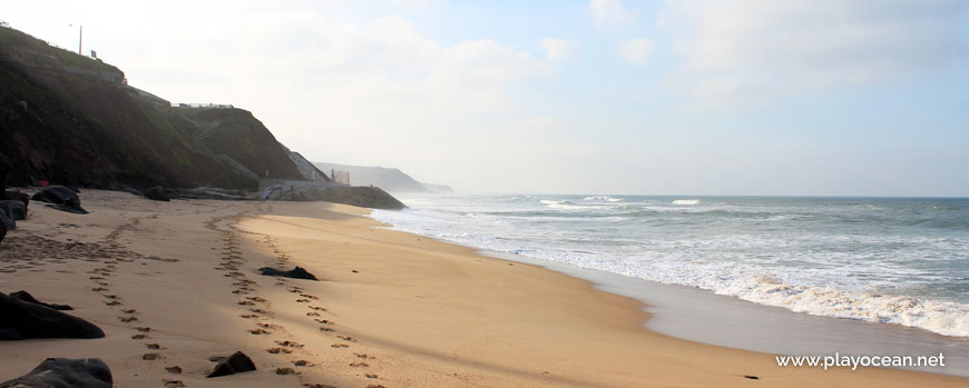
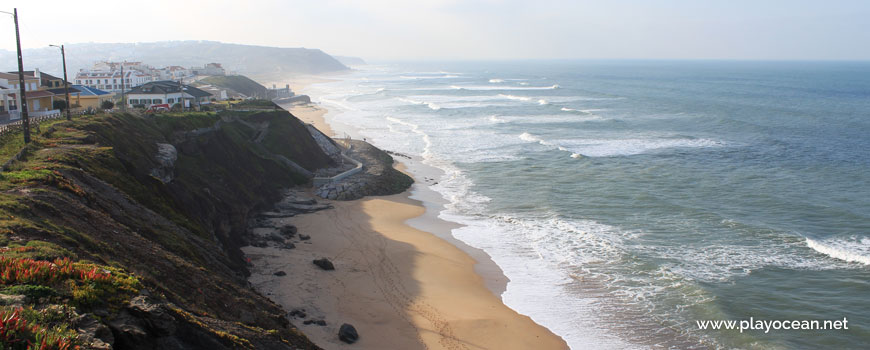
It's an Oceanic Beach in the northern hemisphere bathed by the Atlantic Ocean, located on the coast of Portugal - Iberian Peninsula - in the municipality of Lourinhã.
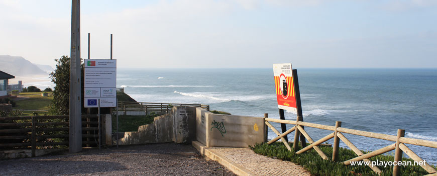
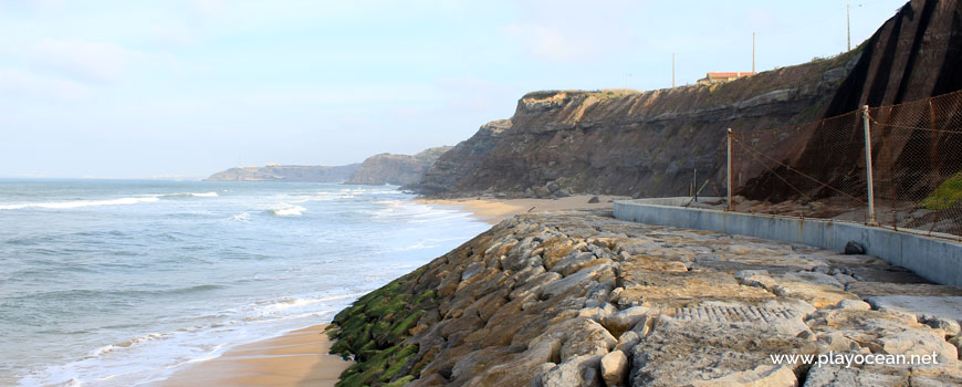
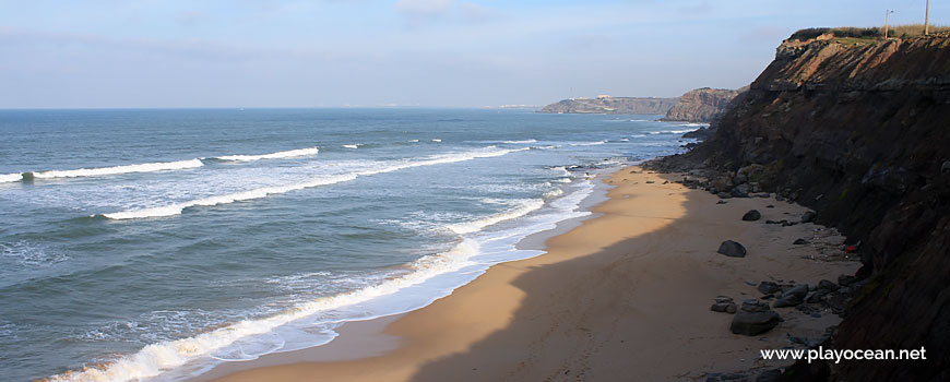
Praia da Malhada Beach presents a sand with a reasonable extension, situated in the north part of Praia da Areia Branca village. The north area hosts a rock mass which becomes immersed during high tide. Further south, the beach exhibits a seawall that goes along the cliff foot until Praia da Areia Branca Beach.
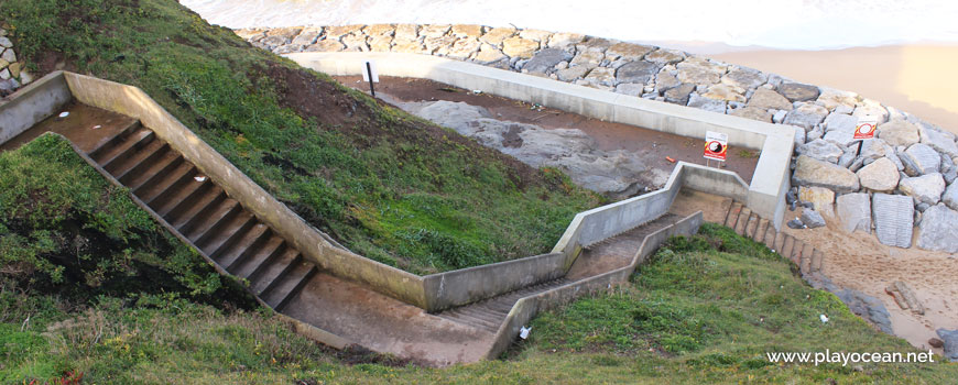
The access is done through a stairway on the south part which descends by a cliff signaled as being unstable due to the danger of landslides. During low tide it is possible to access the beach by walking the sand, coming from the south neighbour beach.
Where is it?
Map of Praia da Malhada Beach
| Coordinates Decimal Degrees (Lat/Long WGS84) Degrees, Decimal Minutes (Lat/Long WGS84) Degrees, Minutes, Seconds (Lat/Long WGS84) |
Lat. 39.268345º Lon. -9.335971º N 39º 16.1007' W 9º 20.15826' N 39º 16' 6.04" W 9º 20' 9.5" |
| Parish | Lourinhã |
| County | Lourinhã |
| District | Leiria |
| Region | Estremadura |
| Country | Portugal |
| Continent | Europe |
| Ocean | North Atlantic |
| Maritime Authority | Capitania do Porto de Peniche |
| Protected Area | |
| Bathing Water | |
| Coastal Unit | Porto de Peniche (Molhe W) - Ponta da Lamporeira |
| Coastal Region | Costa Azul |
Awards
| Award | 2017 | 2016 | 2015 | 2014 | 2013 | 2012 | 2011 | 2010 | 2009 | 2008 | 2007 | 2006 |
|---|---|---|---|---|---|---|---|---|---|---|---|---|
| Water Quality | ||||||||||||
| Blue Flag | ||||||||||||
| Gold Flag | ||||||||||||
| Handicapped-Accessible Beach | ||||||||||||
| Zero Polution |
