Praia de Matosinhos Beach
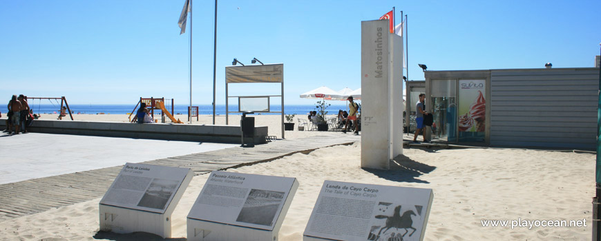
Exhibitors on the entrance of Praia de Matosinhos Beach.
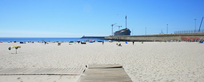
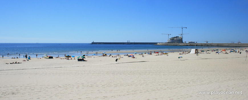
North part of Praia de Matosinhos Beach, near Leixões Port.
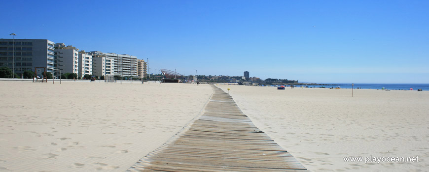
Praia de Matosinhos Beach, wooden walkway along the sand.
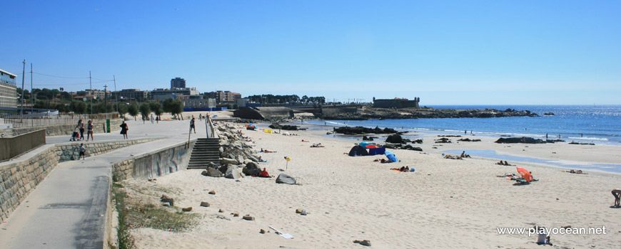
South part of Praia de Matosinhos Beach. Far, the Queijo Castle.
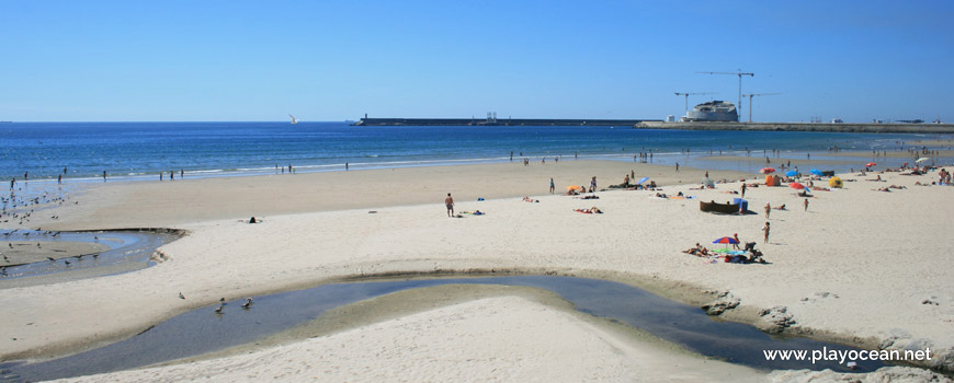
Mouth of the Riguinha Stream.
Praia de Matosinhos Beach.
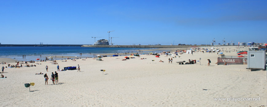
North perspective of Praia de Matosinhos Beach. In the rear, the Leixões Port.
Weather and Tide Table
Sunrise
Sunset
0% | 3,3 m 10.8 ft | High Tide | |
1% | 0,7 m 2.3 ft | Low Tide | |
1% | 3,3 m 10.8 ft | High Tide | |
2% | 0,7 m 2.3 ft | Low Tide | |
2% | 3,3 m 10.8 ft | High Tide | |
3% | 0,7 m 2.3 ft | Low Tide | |
4% | 3,2 m 10.5 ft | High Tide | |
5% | 0,8 m 2.6 ft | Low Tide | |
6% | 3,3 m 10.8 ft | High Tide | |
7% | 0,8 m 2.6 ft | Low Tide | |
9% | 3,1 m 10.2 ft | High Tide | |
10% | 0,9 m 3 ft | Low Tide | |
12% | 3,2 m 10.5 ft | High Tide | |
13% | 0,9 m 3 ft | Low Tide | |
15% | 2,9 m 9.5 ft | High Tide | |
17% | 1,1 m 3.6 ft | Low Tide | |
19% | 3,0 m 9.8 ft | High Tide | |
21% | 1,1 m 3.6 ft | Low Tide | |
23% | 2,8 m 9.2 ft | High Tide | |
25% | 1,2 m 3.9 ft | Low Tide | |
27% | 2,9 m 9.5 ft | High Tide | |
29% | 1,2 m 3.9 ft | Low Tide | |
31% | 2,6 m 8.5 ft | High Tide | |
34% | 1,4 m 4.6 ft | Low Tide | |
36% | 2,7 m 8.9 ft | High Tide | |
39% | 1,4 m 4.6 ft | Low Tide | |
41% | 2,4 m 7.9 ft | High Tide | |
44% | 1,5 m 4.9 ft | Low Tide | |
46% | 2,6 m 8.5 ft | High Tide | |
49% | 1,5 m 4.9 ft | Low Tide | |
52% | 2,4 m 7.9 ft | High Tide | |
54% | 1,6 m 5.2 ft | Low Tide | |
57% | 2,6 m 8.5 ft | High Tide | |
60% | 1,4 m 4.6 ft | Low Tide | |
63% | 2,5 m 8.2 ft | High Tide | |
65% | 1,5 m 4.9 ft | Low Tide | |
68% | 2,8 m 9.2 ft | High Tide | |
71% | 1,2 m 3.9 ft | Low Tide | |
73% | 2,7 m 8.9 ft | High Tide | |
76% | 1,3 m 4.3 ft | Low Tide | |
78% | 3,0 m 9.8 ft | High Tide | |
80% | 1,0 m 3.3 ft | Low Tide | |
83% | 2,9 m 9.5 ft | High Tide | |
About the Beach
What is Praia de Matosinhos Beach?
It's an Oceanic Beach in the northern hemisphere bathed by the Atlantic Ocean, located on the coast of Portugal - Iberian Peninsula - in the municipality of Matosinhos.
Praia de Matosinhos Beach presents a wide and very extensive sand, belonging to the Rio Leça1 mouth by the south margin.
To the north the sand is bounded by a pier of Porto de Leixões2 facilities and to the south, by the well known Rotunda da Anémona3.
Nearby, empty the Ribeira da Riguinha or Ribeira do Couto4 and the Ribeira de Carcavelos5.
This is the most requested beach of Matosinhos county, being located in an area full of catering establishments.
Access is done through Avenida Norton de Matos6.
References
- Leça River
- Leixões Port
- Anémona Roundabout
- Riguinha Stream, also known as Couto Stream
- Carcavelos Stream
- Norton de Matos Avenue
Where is it?
Map of Praia de Matosinhos Beach
| Coordinates Decimal Degrees (Lat/Long WGS84) Degrees, Decimal Minutes (Lat/Long WGS84) Degrees, Minutes, Seconds (Lat/Long WGS84) |
Lat. 41.176750º Lon. -8.691830º N 41º 10.605' W 8º 41.5098' N 41º 10' 36.3" W 8º 41' 30.59" |
| Parish | Matosinhos |
| County | Matosinhos |
| District | Porto |
| Region | Douro Litoral |
| Country | Portugal |
| Continent | Europe |
| Ocean | North Atlantic |
| Maritime Authority | Capitania do Porto de Leixões |
| Protected Area | |
| Bathing Water | Matosinhos |
| Coastal Unit | Cabo de Santo André - Foz do Douro (N) |
| Coastal Region | Costa Verde |
Awards
| Award | 2017 | 2016 | 2015 | 2014 | 2013 | 2012 | 2011 | 2010 | 2009 | 2008 | 2007 | 2006 |
|---|---|---|---|---|---|---|---|---|---|---|---|---|
| Water Quality | ||||||||||||
| Blue Flag | ||||||||||||
| Gold Flag | ||||||||||||
| Handicapped-Accessible Beach | ||||||||||||
| Zero Polution |