Praia do Magoito Beach
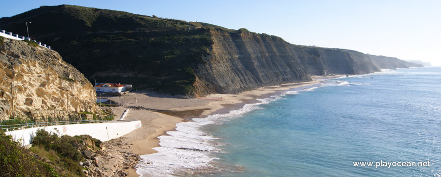
Panoramic view to Praia do Magoito Beach.
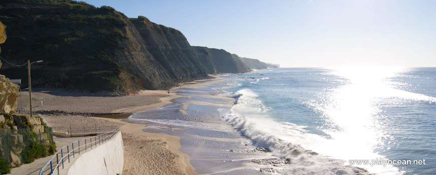
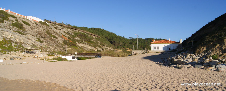
Praia do Magoito Beach, south perspective.

Pedestrian bridge over the bed of the Mata Stream.
Seafront at Praia do Magoito Beach, near the Mata Stream.
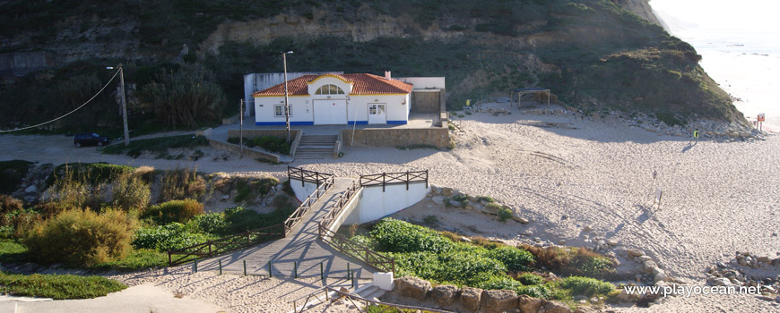
Access ramp to the beach, built on the Consolidated Dune of Magoito's slope.
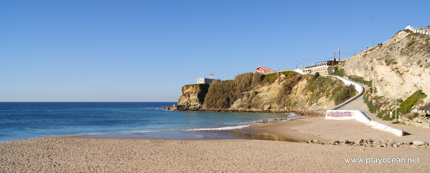
Praia do Magoito Beach, east perspective.
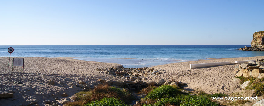
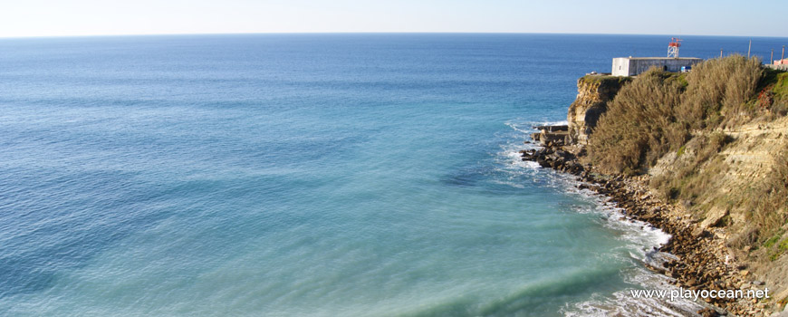
View over the bar at Praia do Magoito Beach.
Bathing area near the Consolidated dune of Magoito.
Weather and Tide Table
Sunset
Sunrise
0% | 3,3 m 10.8 ft | High Tide | |
1% | 0,7 m 2.3 ft | Low Tide | |
1% | 3,3 m 10.8 ft | High Tide | |
2% | 0,7 m 2.3 ft | Low Tide | |
2% | 3,3 m 10.8 ft | High Tide | |
3% | 0,8 m 2.6 ft | Low Tide | |
4% | 3,2 m 10.5 ft | High Tide | |
5% | 0,8 m 2.6 ft | Low Tide | |
6% | 3,2 m 10.5 ft | High Tide | |
7% | 0,9 m 3 ft | Low Tide | |
9% | 3,1 m 10.2 ft | High Tide | |
10% | 0,9 m 3 ft | Low Tide | |
12% | 3,1 m 10.2 ft | High Tide | |
13% | 1,0 m 3.3 ft | Low Tide | |
15% | 2,9 m 9.5 ft | High Tide | |
17% | 1,1 m 3.6 ft | Low Tide | |
19% | 3,0 m 9.8 ft | High Tide | |
21% | 1,1 m 3.6 ft | Low Tide | |
23% | 2,7 m 8.9 ft | High Tide | |
25% | 1,2 m 3.9 ft | Low Tide | |
27% | 2,9 m 9.5 ft | High Tide | |
29% | 1,3 m 4.3 ft | Low Tide | |
31% | 2,6 m 8.5 ft | High Tide | |
34% | 1,4 m 4.6 ft | Low Tide | |
36% | 2,7 m 8.9 ft | High Tide | |
39% | 1,4 m 4.6 ft | Low Tide | |
41% | 2,4 m 7.9 ft | High Tide | |
44% | 1,5 m 4.9 ft | Low Tide | |
46% | 2,6 m 8.5 ft | High Tide | |
49% | 1,5 m 4.9 ft | Low Tide | |
52% | 2,4 m 7.9 ft | High Tide | |
54% | 1,6 m 5.2 ft | Low Tide | |
57% | 2,6 m 8.5 ft | High Tide | |
60% | 1,4 m 4.6 ft | Low Tide | |
63% | 2,5 m 8.2 ft | High Tide | |
65% | 1,5 m 4.9 ft | Low Tide | |
68% | 2,7 m 8.9 ft | High Tide | |
71% | 1,2 m 3.9 ft | Low Tide | |
73% | 2,7 m 8.9 ft | High Tide | |
76% | 1,3 m 4.3 ft | Low Tide | |
78% | 2,9 m 9.5 ft | High Tide | |
80% | 1,0 m 3.3 ft | Low Tide | |
83% | 2,9 m 9.5 ft | High Tide | |
About the Beach
What is Praia do Magoito Beach?
It's an Oceanic Beach in the northern hemisphere bathed by the Atlantic Ocean, located on the coast of Portugal - Iberian Peninsula - in the municipality of Sintra.
Praia do Magoito Beach also known as Praia de Santa Maria do Magoito Beach, has a very long stretch of sand, located in a valley.
In the center and south areas (the last, known by Praia da Taboeira Beach), there are rolled rocks spread throughout the sand.
The access is done down the cliff at north where one finds the Duna Consolidada do Magoito1, classified as a geo monument. The Ribeira da Mata2 empties nearby.
In the sea water exist immersed all along the bathing area.
This is one of the beaches with higher iodine concentration in all Europe.
References
- Magoito Consolidated Dune
- Mata Stream
Where is it?
Map of Praia do Magoito Beach
| Coordinates Decimal Degrees (Lat/Long WGS84) Degrees, Decimal Minutes (Lat/Long WGS84) Degrees, Minutes, Seconds (Lat/Long WGS84) |
Lat. 38.863682º Lon. -9.449210º N 38º 51.82092' W 9º 26.9526' N 38º 51' 49.26" W 9º 26' 57.16" |
| Parish | São João das Lampas |
| County | Sintra |
| District | Lisboa |
| Region | Estremadura |
| Country | Portugal |
| Continent | Europe |
| Ocean | North Atlantic |
| Maritime Authority | Capitania do Porto de Cascais |
| Protected Area | Parque Natural de Sintra-Cascais |
| Bathing Water | Magoito |
| Coastal Unit | Foz do Lizandro - Cabo da Roca |
| Coastal Region | Costa Azul |
Awards
| Award | 2017 | 2016 | 2015 | 2014 | 2013 | 2012 | 2011 | 2010 | 2009 | 2008 | 2007 | 2006 |
|---|---|---|---|---|---|---|---|---|---|---|---|---|
| Water Quality | ||||||||||||
| Blue Flag | ||||||||||||
| Gold Flag | ||||||||||||
| Handicapped-Accessible Beach | ||||||||||||
| Zero Polution |
Documents
Reviews (1)
Login to Review.
-
5/ 10E pena é estar qua e sempre nubladoJoao Miranda 2020-07-12 15:54