Praia do Beliche Beach
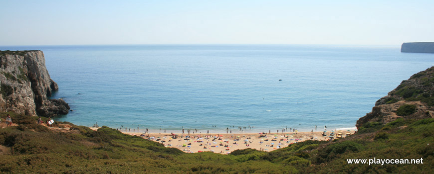
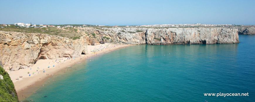
Praia do Beliche Beach, view into the sea.
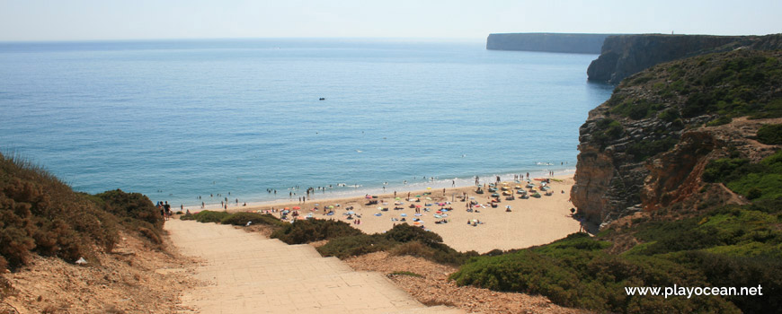
Access stairway to Praia do Beliche Beach.
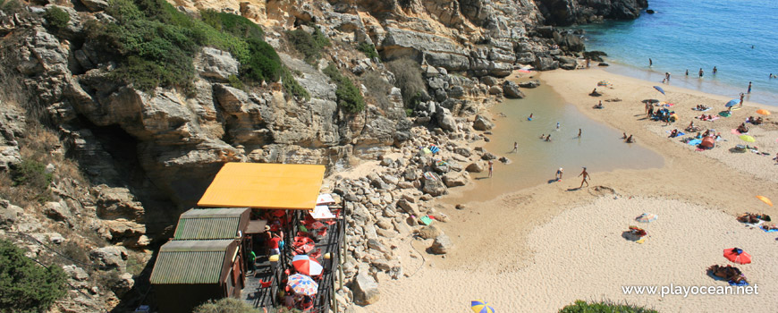
Bar of Praia do Beliche Beach, near the cliff.
Praia do Beliche Beach, the west part.
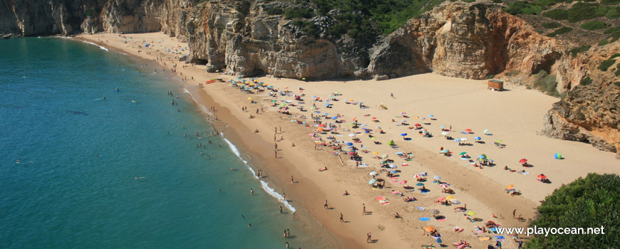
Wide sand at Praia do Beliche Beach.
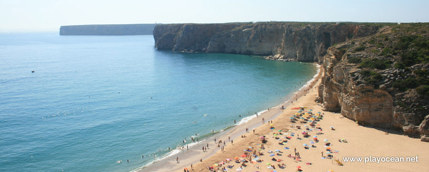
East perspective over Praia do Beliche Beach.
Weather and Tide Table
Sunset
Sunrise
0% | 3,2 m 10.5 ft | High Tide | |
1% | 0,8 m 2.6 ft | Low Tide | |
1% | 3,2 m 10.5 ft | High Tide | |
2% | 0,8 m 2.6 ft | Low Tide | |
2% | 3,2 m 10.5 ft | High Tide | |
3% | 0,8 m 2.6 ft | Low Tide | |
4% | 3,1 m 10.2 ft | High Tide | |
5% | 0,9 m 3 ft | Low Tide | |
6% | 3,2 m 10.5 ft | High Tide | |
7% | 0,9 m 3 ft | Low Tide | |
9% | 3,0 m 9.8 ft | High Tide | |
10% | 1,0 m 3.3 ft | Low Tide | |
12% | 3,1 m 10.2 ft | High Tide | |
13% | 1,0 m 3.3 ft | Low Tide | |
15% | 2,9 m 9.5 ft | High Tide | |
17% | 1,1 m 3.6 ft | Low Tide | |
19% | 3,0 m 9.8 ft | High Tide | |
20% | 1,1 m 3.6 ft | Low Tide | |
22% | 2,7 m 8.9 ft | High Tide | |
24% | 1,3 m 4.3 ft | Low Tide | |
27% | 2,8 m 9.2 ft | High Tide | |
29% | 1,3 m 4.3 ft | Low Tide | |
31% | 2,6 m 8.5 ft | High Tide | |
33% | 1,4 m 4.6 ft | Low Tide | |
36% | 2,7 m 8.9 ft | High Tide | |
39% | 1,4 m 4.6 ft | Low Tide | |
41% | 2,4 m 7.9 ft | High Tide | |
43% | 1,6 m 5.2 ft | Low Tide | |
46% | 2,6 m 8.5 ft | High Tide | |
49% | 1,5 m 4.9 ft | Low Tide | |
52% | 2,4 m 7.9 ft | High Tide | |
54% | 1,6 m 5.2 ft | Low Tide | |
57% | 2,6 m 8.5 ft | High Tide | |
60% | 1,4 m 4.6 ft | Low Tide | |
63% | 2,5 m 8.2 ft | High Tide | |
65% | 1,5 m 4.9 ft | Low Tide | |
68% | 2,7 m 8.9 ft | High Tide | |
70% | 1,3 m 4.3 ft | Low Tide | |
73% | 2,7 m 8.9 ft | High Tide | |
75% | 1,3 m 4.3 ft | Low Tide | |
78% | 2,9 m 9.5 ft | High Tide | |
80% | 1,0 m 3.3 ft | Low Tide | |
83% | 2,9 m 9.5 ft | High Tide | |
About the Beach
What is Praia do Beliche Beach?
It's an Oceanic Beach in the northern hemisphere bathed by the Atlantic Ocean, located on the coast of Portugal - Iberian Peninsula - in the municipality of Vila do Bispo.
Praia do Beliche Beach or Praia do Belixe Beach, has a long sand. It lies in the middle of the Reserva Biogenética de Sagres1, the only place in the world where the nesting of Cegonha-Branca2 occurs on sea cliffs.
The cove where the beach lies, provides some shelter from the wind.
The sea waters are rough and sought by surf enthusiasts.
During heavy rainfall a tiny stream empties at the western area.
The beach can be accessed by Estrada Nacional 268, about 3 Km away from the Cabo de São Vicente4 and 1,9 Km from the ruins of the Fortaleza do Beliche5, to east direction.
References
- Sagres Biogenetic Reserve
- White Stork
- National Road 268
- São Vicente Cape
- Beliche Fort
Where is it?
Map of Praia do Beliche Beach
| Coordinates Decimal Degrees (Lat/Long WGS84) Degrees, Decimal Minutes (Lat/Long WGS84) Degrees, Minutes, Seconds (Lat/Long WGS84) |
Lat. 37.025842º Lon. -8.963248º N 37º 1.55052' W 8º 57.79488' N 37º 1' 33.03" W 8º 57' 47.69" |
| Parish | Sagres |
| County | Vila do Bispo |
| District | Faro |
| Region | Algarve |
| Country | Portugal |
| Continent | Europe |
| Ocean | North Atlantic |
| Maritime Authority | Capitania do Porto de Lagos |
| Protected Area | Parque Natural do Sudoeste Alentejano e Costa Vicentina |
| Bathing Water | Beliche |
| Coastal Unit | Cabo São Vicente - Ponta de Sagres |
| Coastal Region | Costa Vicentina |
Awards
| Award | 2017 | 2016 | 2015 | 2014 | 2013 | 2012 | 2011 | 2010 | 2009 | 2008 | 2007 | 2006 |
|---|---|---|---|---|---|---|---|---|---|---|---|---|
| Water Quality | ||||||||||||
| Blue Flag | ||||||||||||
| Gold Flag | ||||||||||||
| Handicapped-Accessible Beach | ||||||||||||
| Zero Polution |