Praia da Ilha do Pessegueiro Beach
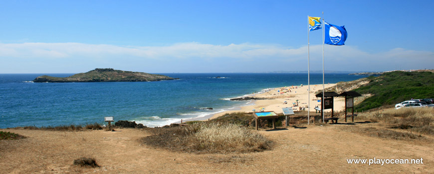
Praia da Ilha do Pessegueiro Beach entrance.
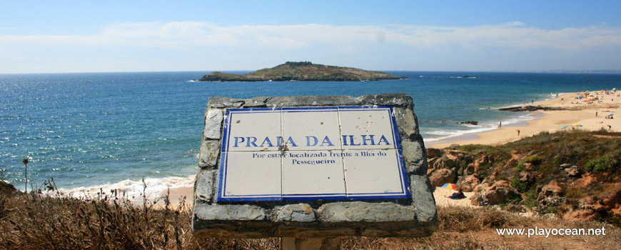
Praia da Ilha do Pessegueiro Beach landmark:
For being located opposite the Pessegueiro Island.
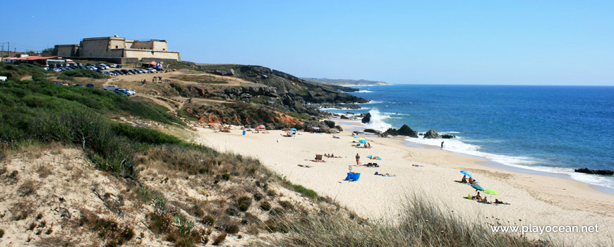
North view of Praia da Ilha do Pessegueiro Beach.
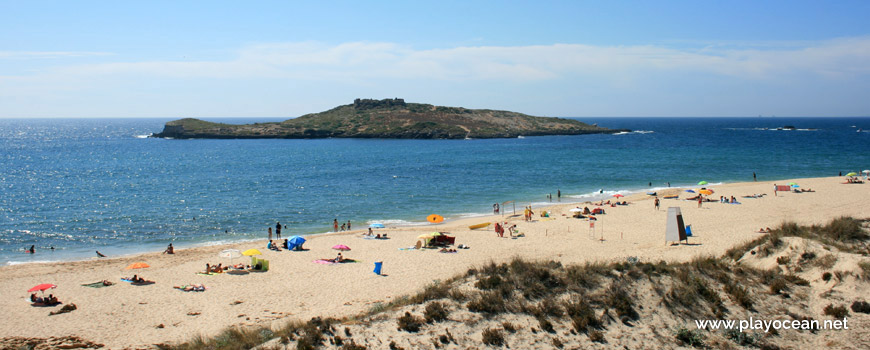
Sand in front of Pessegueiro Island.
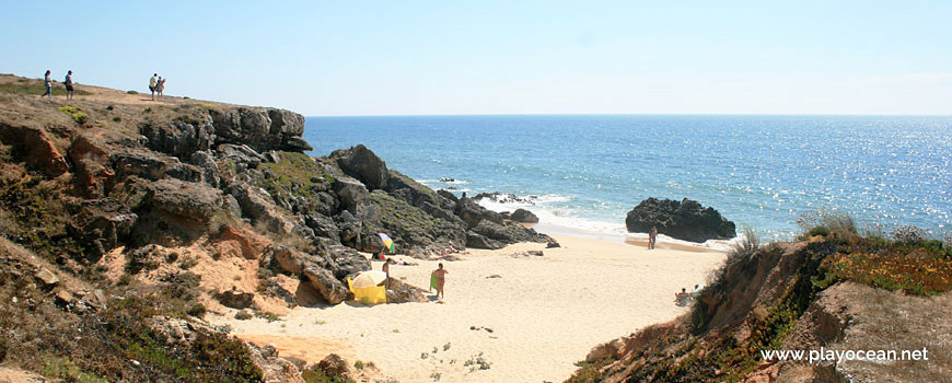
Small sand area between cliffs at the south of Praia da Ilha do Pessegueiro Beach.
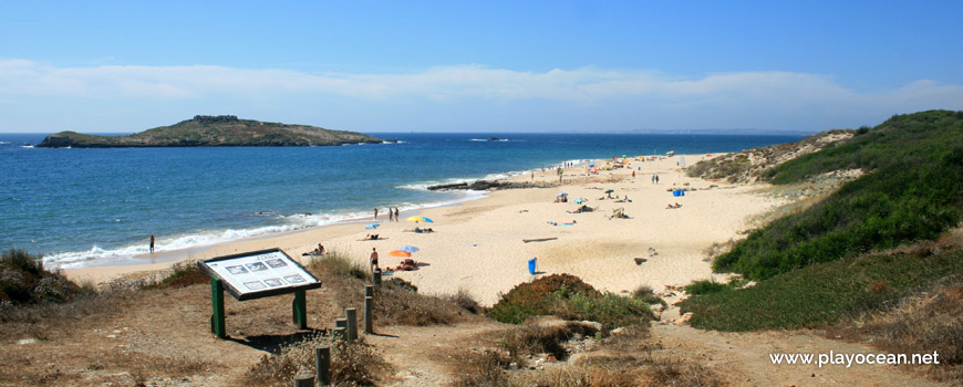
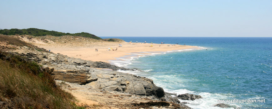
South view of Praia da Ilha do Pessegueiro Beach.
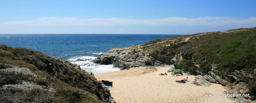
Isolated sand areas, due the high tide, at the north of Praia da Ilha do Pessegueiro Beach.
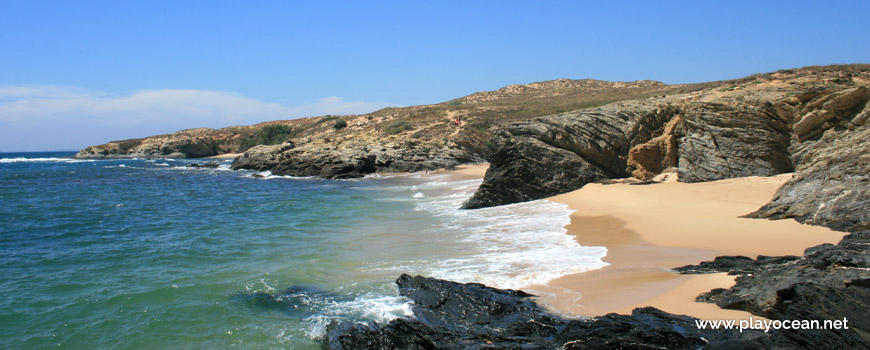
Small sand sheltered from the wind, between the cliffs of the rocky complex at north of Praia da Ilha do Pessegueiro Beach.
North bay of Praia da Ilha do Pessegueiro Beach where it is usual to practice nudism.
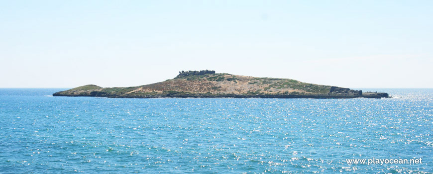
Pessegueiro Island, offshore of Praia da Ilha do Pessegueiro Beach.
Weather and Tide Table
Sunset
Sunrise
0% | 3,2 m 10.5 ft | High Tide | |
1% | 0,8 m 2.6 ft | Low Tide | |
1% | 3,2 m 10.5 ft | High Tide | |
2% | 0,8 m 2.6 ft | Low Tide | |
2% | 3,2 m 10.5 ft | High Tide | |
3% | 0,8 m 2.6 ft | Low Tide | |
4% | 3,1 m 10.2 ft | High Tide | |
5% | 0,9 m 3 ft | Low Tide | |
6% | 3,2 m 10.5 ft | High Tide | |
7% | 0,9 m 3 ft | Low Tide | |
9% | 3,0 m 9.8 ft | High Tide | |
10% | 1,0 m 3.3 ft | Low Tide | |
12% | 3,1 m 10.2 ft | High Tide | |
13% | 1,0 m 3.3 ft | Low Tide | |
15% | 2,9 m 9.5 ft | High Tide | |
17% | 1,1 m 3.6 ft | Low Tide | |
19% | 3,0 m 9.8 ft | High Tide | |
20% | 1,1 m 3.6 ft | Low Tide | |
22% | 2,7 m 8.9 ft | High Tide | |
24% | 1,3 m 4.3 ft | Low Tide | |
27% | 2,8 m 9.2 ft | High Tide | |
29% | 1,3 m 4.3 ft | Low Tide | |
31% | 2,6 m 8.5 ft | High Tide | |
33% | 1,4 m 4.6 ft | Low Tide | |
36% | 2,7 m 8.9 ft | High Tide | |
39% | 1,4 m 4.6 ft | Low Tide | |
41% | 2,4 m 7.9 ft | High Tide | |
43% | 1,6 m 5.2 ft | Low Tide | |
46% | 2,6 m 8.5 ft | High Tide | |
49% | 1,5 m 4.9 ft | Low Tide | |
52% | 2,4 m 7.9 ft | High Tide | |
54% | 1,6 m 5.2 ft | Low Tide | |
57% | 2,6 m 8.5 ft | High Tide | |
60% | 1,4 m 4.6 ft | Low Tide | |
63% | 2,5 m 8.2 ft | High Tide | |
65% | 1,5 m 4.9 ft | Low Tide | |
68% | 2,7 m 8.9 ft | High Tide | |
70% | 1,3 m 4.3 ft | Low Tide | |
73% | 2,7 m 8.9 ft | High Tide | |
75% | 1,3 m 4.3 ft | Low Tide | |
78% | 2,9 m 9.5 ft | High Tide | |
80% | 1,0 m 3.3 ft | Low Tide | |
83% | 2,9 m 9.5 ft | High Tide | |
About the Beach
What is Praia da Ilha do Pessegueiro Beach?
It's an Oceanic Beach in the northern hemisphere bathed by the Atlantic Ocean, located on the coast of Portugal - Iberian Peninsula - in the municipality of Sines.
Praia da Ilha do Pessegueiro Beach, or Praia da Ilha Beach, has a very extensive and wide sand.
To east of the beach, the landscape is divided into dune to north and bush to south. The central area is the place where the Corgo do Pessegueiro empties.
Opposite to the beach stands the Forte da Ilha de Dentro1, at the massive Ilha do Pessegueiro2. At mainland, complementing an old gone military defense system, lies the Forte do Pessegueiro3.
References
- Ilha de Dentro Fort
- Pessegueiro Island
- Pessegueiro Fort
Where is it?
Map of Praia da Ilha do Pessegueiro Beach
| Coordinates Decimal Degrees (Lat/Long WGS84) Degrees, Decimal Minutes (Lat/Long WGS84) Degrees, Minutes, Seconds (Lat/Long WGS84) |
Lat. 37.830131º Lon. -8.791847º N 37º 49.80786' W 8º 47.51082' N 37º 49' 48.47" W 8º 47' 30.65" |
| Parish | Porto Covo |
| County | Sines |
| District | Setúbal |
| Region | Baixo Alentejo |
| Country | Portugal |
| Continent | Europe |
| Ocean | North Atlantic |
| Maritime Authority | Capitania do Porto de Sines |
| Protected Area | Parque Natural do Sudoeste Alentejano e Costa Vicentina |
| Bathing Water | Ilha do Pessegueiro |
| Coastal Unit | São Torpes (N) - Pedra da Foz (Vila Nova de Milfontes) |
| Coastal Region | Costa Azul |
Awards
| Award | 2017 | 2016 | 2015 | 2014 | 2013 | 2012 | 2011 | 2010 | 2009 | 2008 | 2007 | 2006 |
|---|---|---|---|---|---|---|---|---|---|---|---|---|
| Water Quality | ||||||||||||
| Blue Flag | ||||||||||||
| Gold Flag | ||||||||||||
| Handicapped-Accessible Beach | ||||||||||||
| Zero Polution |