Praia de São Lourenço Beach
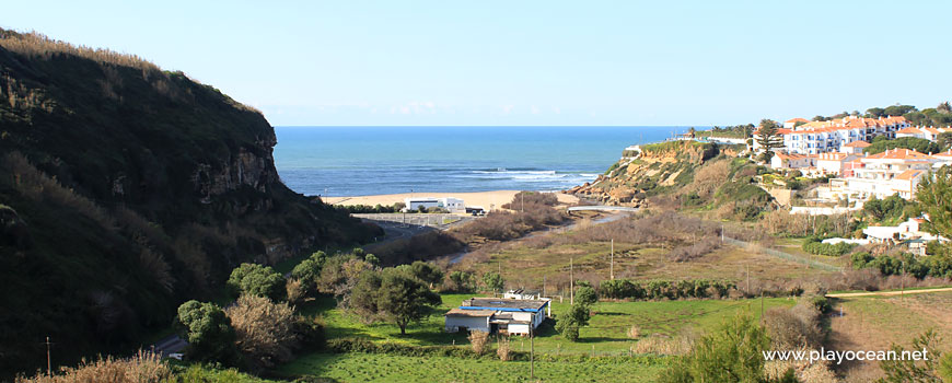
Verdant valley. In the rear, the Praia de São Lourenço Beach.
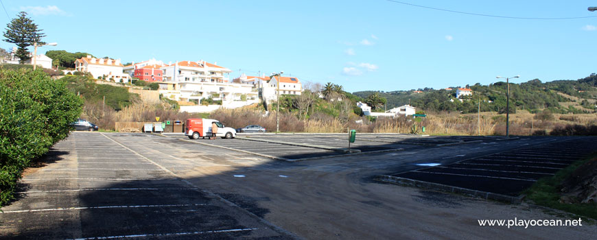
Car parking at Praia de São Lourenço Beach.
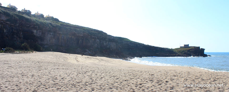
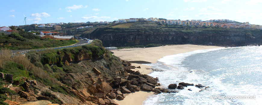
Praia de São Lourenço Beach, the south part.
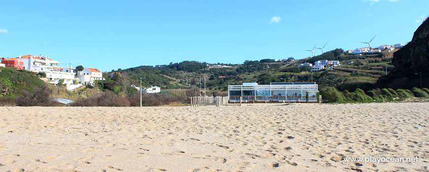
Beach bar adorned by the greenish hills behind.
North part at Praia de São Lourenço Beach.
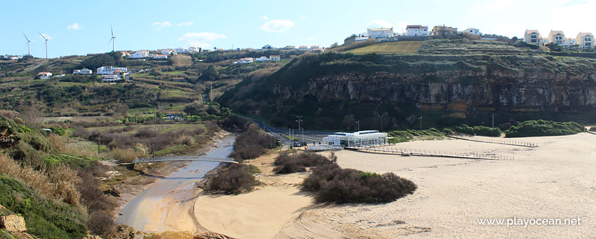
Mouth of the Safarujo or Sobral River, on the sand.
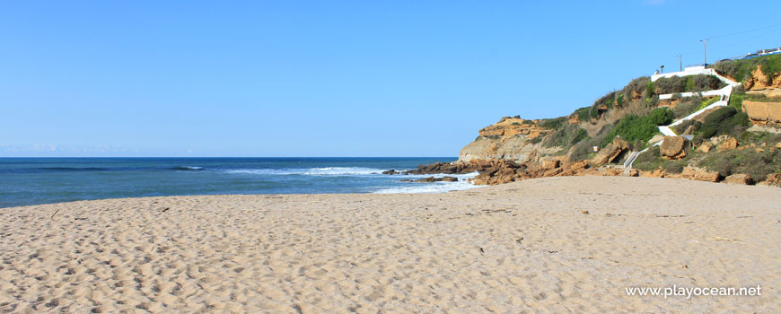
South perspective at Praia de São Lourenço Beach.
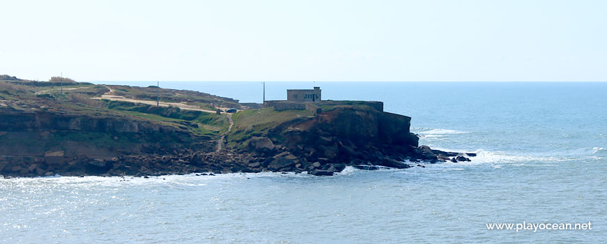
The Santa Susana Fort on top of the south cliff.
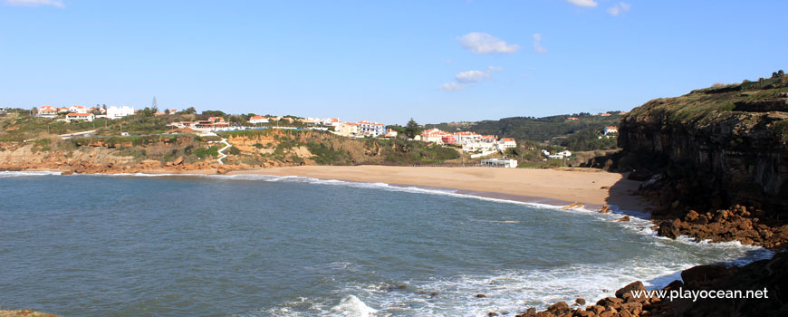
Panoramic view to Praia de São Lourenço Beach.
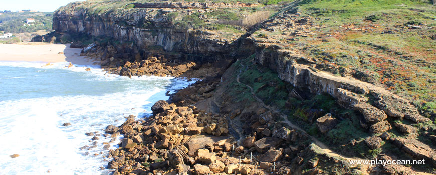
Praia de São Lourenço Beach, fishermen trail on the south cliff.
Weather and Tide Table
Sunrise
Sunset
0% | 3,3 m 10.8 ft | High Tide | |
1% | 0,7 m 2.3 ft | Low Tide | |
1% | 3,3 m 10.8 ft | High Tide | |
2% | 0,7 m 2.3 ft | Low Tide | |
2% | 3,3 m 10.8 ft | High Tide | |
3% | 0,8 m 2.6 ft | Low Tide | |
4% | 3,2 m 10.5 ft | High Tide | |
5% | 0,8 m 2.6 ft | Low Tide | |
6% | 3,2 m 10.5 ft | High Tide | |
7% | 0,9 m 3 ft | Low Tide | |
9% | 3,1 m 10.2 ft | High Tide | |
10% | 0,9 m 3 ft | Low Tide | |
12% | 3,1 m 10.2 ft | High Tide | |
13% | 1,0 m 3.3 ft | Low Tide | |
15% | 2,9 m 9.5 ft | High Tide | |
17% | 1,1 m 3.6 ft | Low Tide | |
19% | 3,0 m 9.8 ft | High Tide | |
21% | 1,1 m 3.6 ft | Low Tide | |
23% | 2,7 m 8.9 ft | High Tide | |
25% | 1,2 m 3.9 ft | Low Tide | |
27% | 2,9 m 9.5 ft | High Tide | |
29% | 1,3 m 4.3 ft | Low Tide | |
31% | 2,6 m 8.5 ft | High Tide | |
34% | 1,4 m 4.6 ft | Low Tide | |
36% | 2,7 m 8.9 ft | High Tide | |
39% | 1,4 m 4.6 ft | Low Tide | |
41% | 2,4 m 7.9 ft | High Tide | |
44% | 1,5 m 4.9 ft | Low Tide | |
46% | 2,6 m 8.5 ft | High Tide | |
49% | 1,5 m 4.9 ft | Low Tide | |
52% | 2,4 m 7.9 ft | High Tide | |
54% | 1,6 m 5.2 ft | Low Tide | |
57% | 2,6 m 8.5 ft | High Tide | |
60% | 1,4 m 4.6 ft | Low Tide | |
63% | 2,5 m 8.2 ft | High Tide | |
65% | 1,5 m 4.9 ft | Low Tide | |
68% | 2,7 m 8.9 ft | High Tide | |
71% | 1,2 m 3.9 ft | Low Tide | |
73% | 2,7 m 8.9 ft | High Tide | |
76% | 1,3 m 4.3 ft | Low Tide | |
78% | 2,9 m 9.5 ft | High Tide | |
80% | 1,0 m 3.3 ft | Low Tide | |
83% | 2,9 m 9.5 ft | High Tide | |
About the Beach
What is Praia de São Lourenço Beach?
It's an Oceanic Beach in the northern hemisphere bathed by the Atlantic Ocean, located on the coast of Portugal - Iberian Peninsula - in the municipality of Mafra.
Praia de São Lourenço Beach presents an extensive and very wide sand, always accompanied by the Forte de Santa Susana.
At center, exists a walkway over the Rio Safarujo or Rio do Sobral that empties in here.
The sea waters are conducive to surf practice in this World Surfing Reserve beach.
Access is available through a tarmac road which ends in a support car parking that connects with Estrada Nacional 247.
References
- National Road 247
Where is it?
Map of Praia de São Lourenço Beach
| Coordinates Decimal Degrees (Lat/Long WGS84) Degrees, Decimal Minutes (Lat/Long WGS84) Degrees, Minutes, Seconds (Lat/Long WGS84) |
Lat. 39.011816º Lon. -9.421350º N 39º 0.70896' W 9º 25.281' N 39º 0' 42.54" W 9º 25' 16.86" |
| Parish | Santo Isidoro |
| County | Mafra |
| District | Lisboa |
| Region | Estremadura |
| Country | Portugal |
| Continent | Europe |
| Ocean | North Atlantic |
| Maritime Authority | Capitania do Porto de Cascais |
| Protected Area | Ericeira World Surfing Reserve |
| Bathing Water | S. Lourenço |
| Coastal Unit | Ponta da Lamporeira - Foz do Lizandro |
| Coastal Region | Costa Azul |
Awards
| Award | 2017 | 2016 | 2015 | 2014 | 2013 | 2012 | 2011 | 2010 | 2009 | 2008 | 2007 | 2006 |
|---|---|---|---|---|---|---|---|---|---|---|---|---|
| Water Quality | ||||||||||||
| Blue Flag | ||||||||||||
| Gold Flag | ||||||||||||
| Handicapped-Accessible Beach | ||||||||||||
| Zero Polution |