Praia da Quebrada Beach
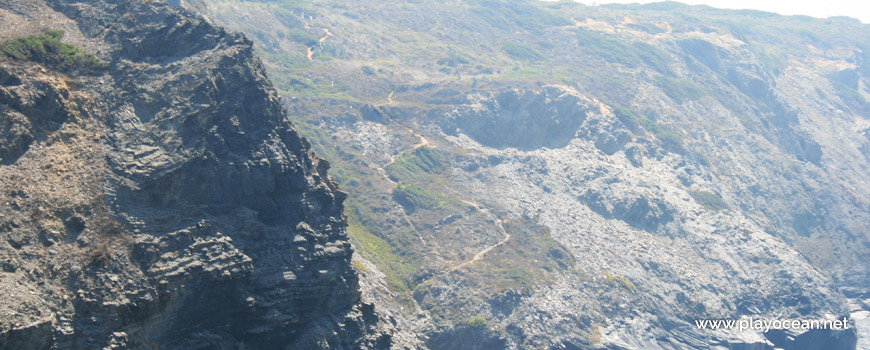
Trail on the access cliff to Praia da Quebrada Beach.
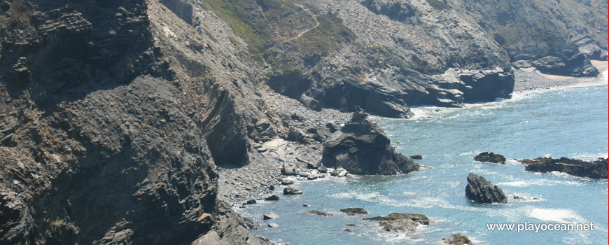
Praia da Quebrada Beach.
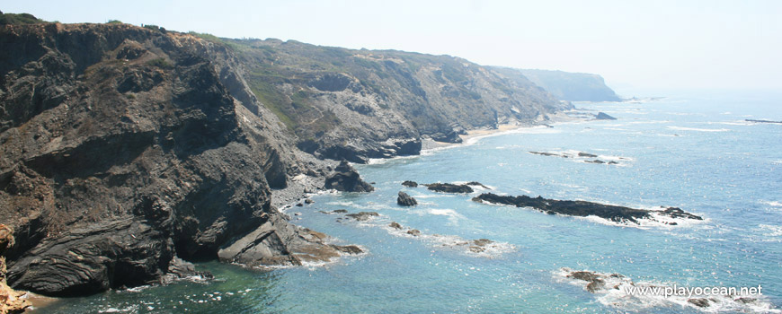
South perspective at Praia da Quebrada Beach.
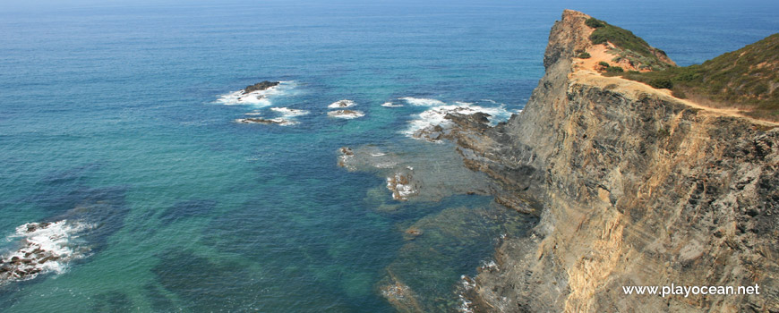
Praia da Quebrada Beach, the north part.
Weather and Tide Table
Sunset
Sunrise
0% | 3,2 m 10.5 ft | High Tide | |
1% | 0,8 m 2.6 ft | Low Tide | |
1% | 3,2 m 10.5 ft | High Tide | |
2% | 0,8 m 2.6 ft | Low Tide | |
2% | 3,2 m 10.5 ft | High Tide | |
3% | 0,8 m 2.6 ft | Low Tide | |
4% | 3,1 m 10.2 ft | High Tide | |
5% | 0,9 m 3 ft | Low Tide | |
6% | 3,2 m 10.5 ft | High Tide | |
7% | 0,9 m 3 ft | Low Tide | |
9% | 3,0 m 9.8 ft | High Tide | |
10% | 1,0 m 3.3 ft | Low Tide | |
12% | 3,1 m 10.2 ft | High Tide | |
13% | 1,0 m 3.3 ft | Low Tide | |
15% | 2,9 m 9.5 ft | High Tide | |
17% | 1,1 m 3.6 ft | Low Tide | |
19% | 3,0 m 9.8 ft | High Tide | |
20% | 1,1 m 3.6 ft | Low Tide | |
22% | 2,7 m 8.9 ft | High Tide | |
24% | 1,3 m 4.3 ft | Low Tide | |
27% | 2,8 m 9.2 ft | High Tide | |
29% | 1,3 m 4.3 ft | Low Tide | |
31% | 2,6 m 8.5 ft | High Tide | |
33% | 1,4 m 4.6 ft | Low Tide | |
36% | 2,7 m 8.9 ft | High Tide | |
39% | 1,4 m 4.6 ft | Low Tide | |
41% | 2,4 m 7.9 ft | High Tide | |
43% | 1,6 m 5.2 ft | Low Tide | |
46% | 2,6 m 8.5 ft | High Tide | |
49% | 1,5 m 4.9 ft | Low Tide | |
52% | 2,4 m 7.9 ft | High Tide | |
54% | 1,6 m 5.2 ft | Low Tide | |
57% | 2,6 m 8.5 ft | High Tide | |
60% | 1,4 m 4.6 ft | Low Tide | |
63% | 2,5 m 8.2 ft | High Tide | |
65% | 1,5 m 4.9 ft | Low Tide | |
68% | 2,7 m 8.9 ft | High Tide | |
70% | 1,3 m 4.3 ft | Low Tide | |
73% | 2,7 m 8.9 ft | High Tide | |
75% | 1,3 m 4.3 ft | Low Tide | |
78% | 2,9 m 9.5 ft | High Tide | |
80% | 1,0 m 3.3 ft | Low Tide | |
83% | 2,9 m 9.5 ft | High Tide | |
About the Beach
What is Praia da Quebrada Beach?
It's an Oceanic Beach in the northern hemisphere bathed by the Atlantic Ocean, located on the coast of Portugal - Iberian Peninsula - in the municipality of Aljezur.
Praia da Quebrada Beach, also known as Praia da Baía dos Tiros Beach, is characterized for having numerous rocks beside the bathing area.
The little existent sand gets immersed during high tide.
When the tide is low there's a vast area of rocky slab intersected by some strips of sand.
The access is achieved through a trail on a steep and rocky scarp of the cliff, beside an isolated house.
Where is it?
Map of Praia da Quebrada Beach
| Coordinates Decimal Degrees (Lat/Long WGS84) Degrees, Decimal Minutes (Lat/Long WGS84) Degrees, Minutes, Seconds (Lat/Long WGS84) |
Lat. 37.413708º Lon. -8.808605º N 37º 24.82248' W 8º 48.5163' N 37º 24' 49.35" W 8º 48' 30.98" |
| Parish | Rogil |
| County | Aljezur |
| District | Faro |
| Region | Algarve |
| Country | Portugal |
| Continent | Europe |
| Ocean | North Atlantic |
| Maritime Authority | Capitania do Porto de Lagos |
| Protected Area | Parque Natural do Sudoeste Alentejano e Costa Vicentina |
| Bathing Water | |
| Coastal Unit | Cabo Sardão - Ponta da Atalaia |
| Coastal Region | Costa Vicentina |
Awards
| Award | 2017 | 2016 | 2015 | 2014 | 2013 | 2012 | 2011 | 2010 | 2009 | 2008 | 2007 | 2006 |
|---|---|---|---|---|---|---|---|---|---|---|---|---|
| Water Quality | ||||||||||||
| Blue Flag | ||||||||||||
| Gold Flag | ||||||||||||
| Handicapped-Accessible Beach | ||||||||||||
| Zero Polution |