Praia do Molhe Leste Beach
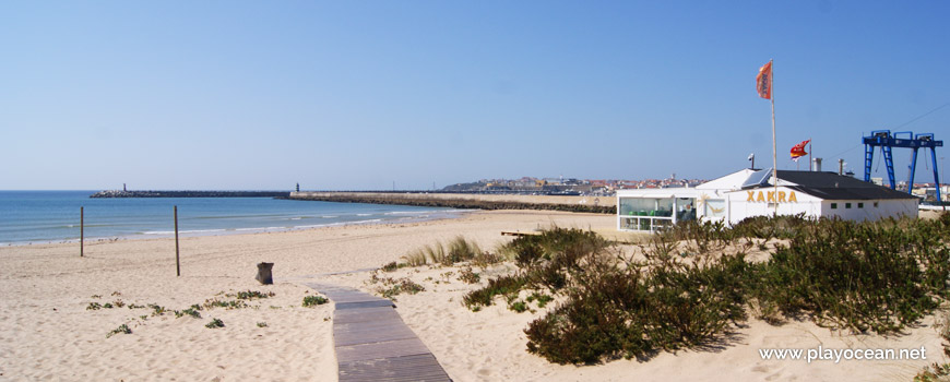
Walkway towards the sand of Praia do Molhe Leste Beach. To the right, the bar.
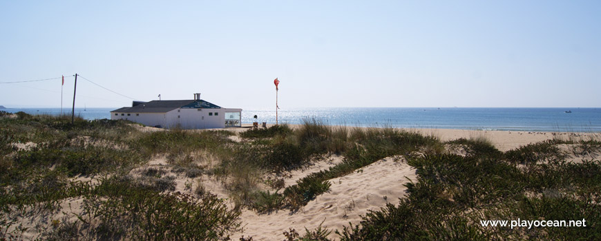
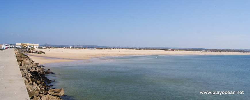
Praia do Molhe Leste Beach, the bar viewed from the dunes.
Perspective to the bar of Ribeira Marina, near Molhe Leste (in English, "East Pier)".
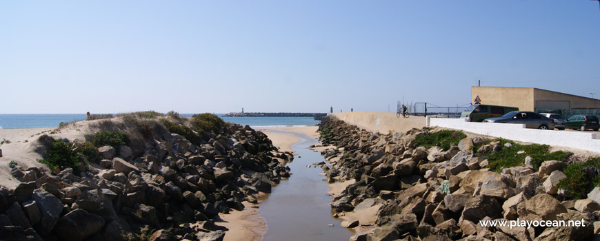
Mouth of the São Domingos River or the Atouguia Stream.
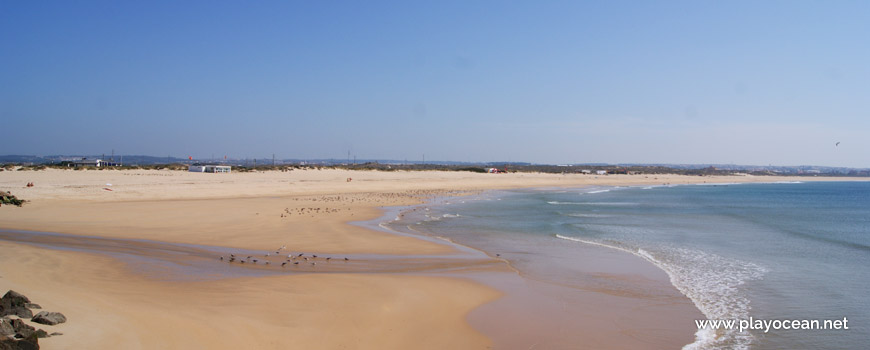
Water line at Praia do Molhe Leste Beach.
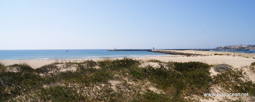
Panoramic view to Praia do Molhe Leste Beach, from the pier which originated the beach name.
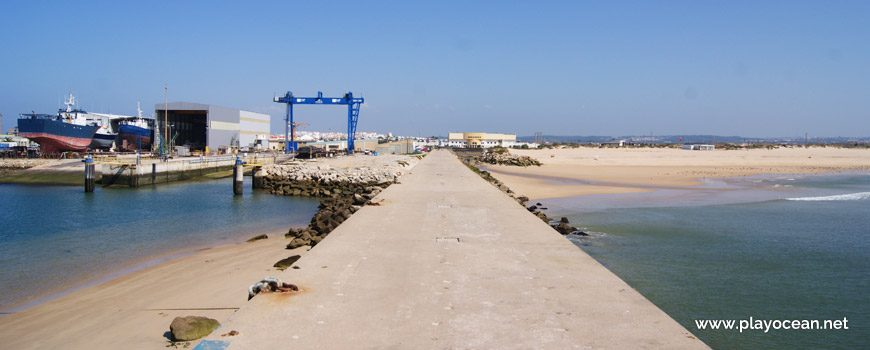
Molhe Leste (in English, "East Pier"). To the left, the naval facilities of Ribeira Marina.
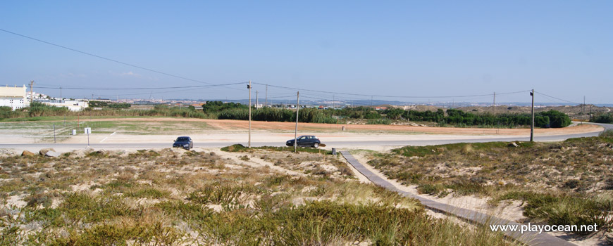
Car parking at Praia do Molhe Leste Beach, view from the dunes.
Weather and Tide Table
Sunrise
Sunset
0% | 3,3 m 10.8 ft | High Tide | |
1% | 0,7 m 2.3 ft | Low Tide | |
1% | 3,3 m 10.8 ft | High Tide | |
2% | 0,7 m 2.3 ft | Low Tide | |
2% | 3,3 m 10.8 ft | High Tide | |
3% | 0,8 m 2.6 ft | Low Tide | |
4% | 3,2 m 10.5 ft | High Tide | |
5% | 0,8 m 2.6 ft | Low Tide | |
6% | 3,2 m 10.5 ft | High Tide | |
7% | 0,9 m 3 ft | Low Tide | |
9% | 3,1 m 10.2 ft | High Tide | |
10% | 0,9 m 3 ft | Low Tide | |
12% | 3,1 m 10.2 ft | High Tide | |
13% | 1,0 m 3.3 ft | Low Tide | |
15% | 2,9 m 9.5 ft | High Tide | |
17% | 1,1 m 3.6 ft | Low Tide | |
19% | 3,0 m 9.8 ft | High Tide | |
21% | 1,1 m 3.6 ft | Low Tide | |
23% | 2,7 m 8.9 ft | High Tide | |
25% | 1,2 m 3.9 ft | Low Tide | |
27% | 2,9 m 9.5 ft | High Tide | |
29% | 1,3 m 4.3 ft | Low Tide | |
31% | 2,6 m 8.5 ft | High Tide | |
34% | 1,4 m 4.6 ft | Low Tide | |
36% | 2,7 m 8.9 ft | High Tide | |
39% | 1,4 m 4.6 ft | Low Tide | |
41% | 2,4 m 7.9 ft | High Tide | |
44% | 1,5 m 4.9 ft | Low Tide | |
46% | 2,6 m 8.5 ft | High Tide | |
49% | 1,5 m 4.9 ft | Low Tide | |
52% | 2,4 m 7.9 ft | High Tide | |
54% | 1,6 m 5.2 ft | Low Tide | |
57% | 2,6 m 8.5 ft | High Tide | |
60% | 1,4 m 4.6 ft | Low Tide | |
63% | 2,5 m 8.2 ft | High Tide | |
65% | 1,5 m 4.9 ft | Low Tide | |
68% | 2,7 m 8.9 ft | High Tide | |
71% | 1,2 m 3.9 ft | Low Tide | |
73% | 2,7 m 8.9 ft | High Tide | |
76% | 1,3 m 4.3 ft | Low Tide | |
78% | 2,9 m 9.5 ft | High Tide | |
80% | 1,0 m 3.3 ft | Low Tide | |
83% | 2,9 m 9.5 ft | High Tide | |
About the Beach
What is Praia do Molhe Leste Beach?
It's an Oceanic Beach in the northern hemisphere bathed by the Atlantic Ocean, located on the coast of Portugal - Iberian Peninsula - in the municipality of Peniche.
Praia do Molhe Leste Beach acquired its name for being north bounded by a pier with over 700 meters long, integrating the Marina da Ribeira bar. It's part of Praia do Medão Grande Beach.
The sand is extensive and an agitated se delights water sports enthusiasts, especially for surfers.
Beside the pier in the beach's northern part, the Rio de São Domingos or Ribeira de Atouguia1.
Access is granted by going through Itinerário Principal 62, reached the roundabout one turns left.
References
- São Domingos River, also known as Atougia Stream
- 6th Main Route
Where is it?
Map of Praia do Molhe Leste Beach
| Coordinates Decimal Degrees (Lat/Long WGS84) Degrees, Decimal Minutes (Lat/Long WGS84) Degrees, Minutes, Seconds (Lat/Long WGS84) |
Lat. 39.350077º Lon. -9.367004º N 39º 21.00462' W 9º 22.02024' N 39º 21' 0.28" W 9º 22' 1.21" |
| Parish | Ajuda |
| County | Peniche |
| District | Leiria |
| Region | Estremadura |
| Country | Portugal |
| Continent | Europe |
| Ocean | North Atlantic |
| Maritime Authority | Capitania do Porto de Peniche |
| Protected Area | |
| Bathing Water | Molhe Leste |
| Coastal Unit | Porto de Peniche (Molhe W) - Ponta da Lamporeira |
| Coastal Region | Costa de Prata |
Awards
| Award | 2017 | 2016 | 2015 | 2014 | 2013 | 2012 | 2011 | 2010 | 2009 | 2008 | 2007 | 2006 |
|---|---|---|---|---|---|---|---|---|---|---|---|---|
| Water Quality | ||||||||||||
| Blue Flag | ||||||||||||
| Gold Flag | ||||||||||||
| Handicapped-Accessible Beach | ||||||||||||
| Zero Polution |